Trek to Balu ka Ghera campsite is moderate and is another beautiful campsite. It is a short meadow walk followed by a boulder section for a couple of hours, leading to a trail on loose rocks all the way to the campsite. By the way, Jwara is one of the most beautiful campsites in the Himalayas.
Firstly, a very gradual incline through the day right next to the stream. Secondly, During the monsoon, because of the rain, you get to see a lot of unnamed waterfalls. Just for fun, you are free to keep your own name to one of these waterfalls. On this day you will gain approx 1,500 feet and will hike right next to the Rani river. The melting of snow forms the stream and hence the river Rani, which flows down all the way to the Hampta Valley. In front are snow-clad mountains beyond which lies the Hampta Pass.
Rani River on the way to the campsite
A visit to Dabha
Visit the Dabha if it is open and have warm tea. Surprisingly, it is not overpriced considering the location of dabha. The Dabha owner can play mouth-organ. Request him as he is happy to play it for you and do not forget to appreciate it. On request, he kept us entertained with some melodious music, while we had snacks, hot spicy maggie, and much-needed warm masala tea on a rainy day. Make sure to go around the dabha and try to pick any leftover plastic items and keep the Himalayan slopes clean. We follow this in all the slopes.
Ravindra Joisa in front of Dabha - Hampta Pass trek
Valley before reaching the campsite
Walk along the Rani river heading into the valley. On your way to the campsite, you will find a variety of tiny flowers – purple, yellow, pink, etc. There are high chances of you finding some wild strawberries on the way. It takes about half an hour to cross the valley. After you come out of Jwara, you need to walk further along. The terrain flattens as you reach Chota Balu Ka Ghera where you can rest for a bit and have a packed lunch.
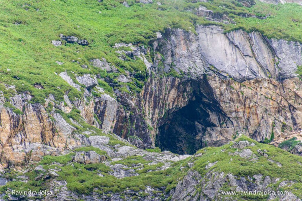
Continue further along the river, crossing small snow flows and jumping across rocks. Towards the end, the rocks are quite far apart, and jumping across the gets tricky. Soon after, you will reach your destination for the day. By the way, to the right of the trail just before the campsite is a huge cave. Explore this place if time permits.
Cave near the Campsite. Photo: Ravindra Joisa
About Campsite
Balu Ka Ghera or the bed of sand is the last campsite before Hampta Pass. In addition, the ground is formed mainly by the sand and dust brought down by the mountain slopes and the streams around the campsite. The water is ice cold and if you can manage to walk in the sand bed then there is a stone at the center of the sand bed where you can sit for a while and enjoy the entire trail that you just covered.
It is level ground and behind you are the mountains you will traverse the next day to cross the famous Hampta Pass. Pitch your tent and enjoy a beautiful sunset behind the Bandarpunch peak. Moreover, you are now close to 12,500 ft (Balu ka Ghera altitude) above sea level.
Balu Ka Ghera or the bed of sand - Hampta Pass trek. Photo: Ravindra Joisa
In conclusion, this is a wonderful campsite to explore. Spend less time inside the tent and use it only to sleep. Spend all your time outdoor. Check out Trek to this campsite from Jwara, day 3 of Hampta Pass trek on my YouTube channel, and consider SUBSCRIBING.
The river place nature trail is a picturesque, riverfront park offering a popular forested hiking trail, small waterfalls & wildlife views. If you are wondering where to go hiking in Austin then river place nature, also known by the name Canyon trail is an ideal weekend getaway. This place is about 20 minutes drive from Austin downtown or from Roundrock. River place nature is almost 3 miles long, one way, and has connectivity by road at both ends. On one end it starts with a mini lake with fountains in between.
Boardwalk at River place nature trail; Image: Ravindra Joisa
Hiking Trail entrance
The river place nature trail begins with a boardwalk surrounding the lake followed by hiking next to a stream. If you are not keen to go on a hike for 2 hours, you might want to consider sitting on the bench on the boardwalk. This is a peaceful place when there is less crowd. Also, there is a fountain in the middle of the lake and forest around.
The golf course as seen from the river place nature trail
About the River Place Nature Trail
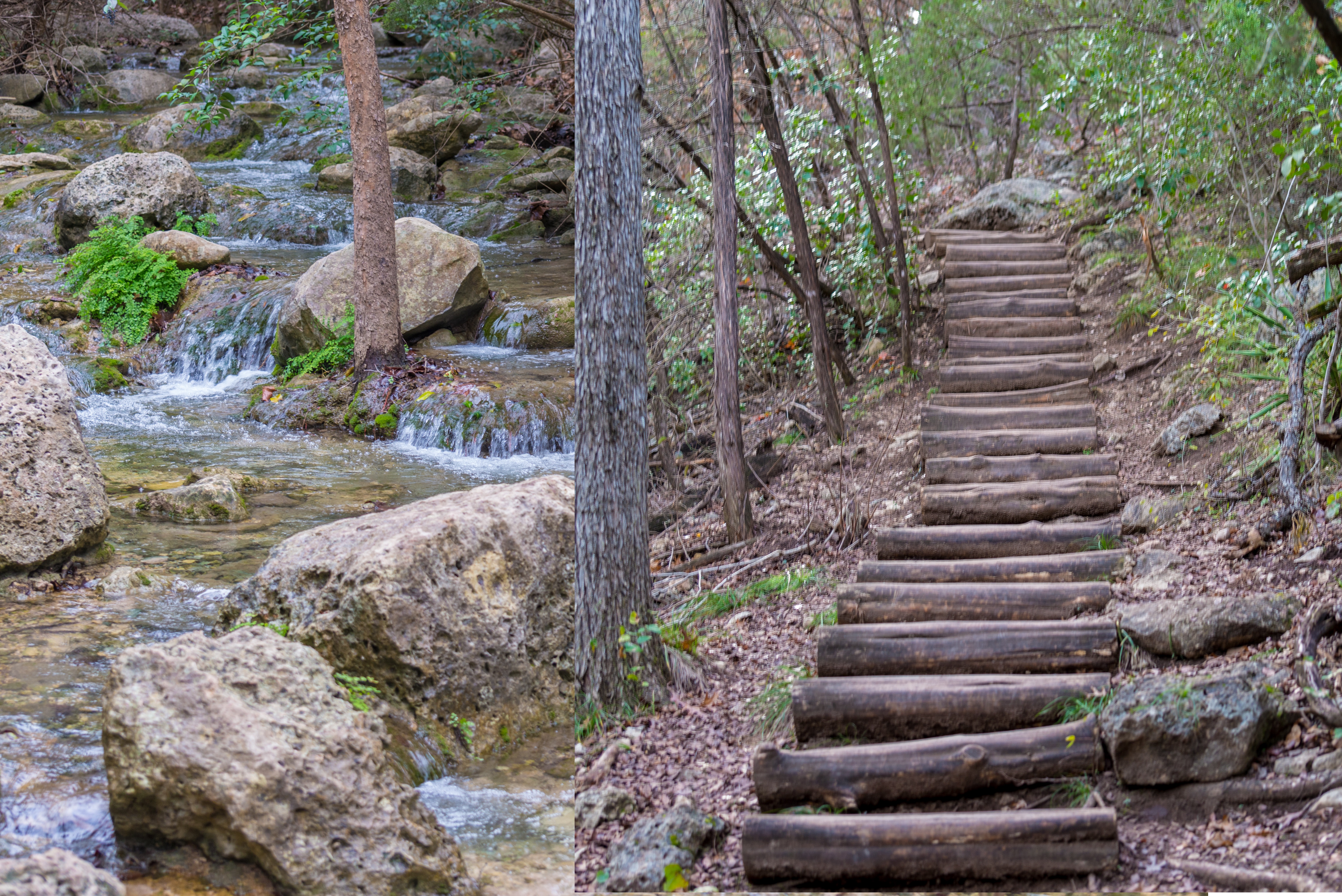
The trail is a continuous ascent and descent, next to a private golf course. You get to see the hilltop villas as you hike along the river place nature trail. Even though the trail doesn't feel like a trail in the rain forest, there is an abundant supply of water. All along the trail, you get to see a stream next to the trail. As you walk along there are wooden logs, to cross with a few markings along the trail showing the direction. Note that this Canyon trail has nothing to do with the grand canyon or the antelope.
Wild berries and leaves
What hiking trails are open in Austin
I visited this place in mid-December. As a result, the area appeared dry. You may spot some bright-colored leaves and wild berries on the way. The trail appears to be well maintained at some of the places. There was no entry fee back then when I visited. But at present, there is a $ 10 entry fee if you go on a hike on weekends. This is a perfect place if you want to go on a hike with your pet dog. The entry to this trail can also be done from the exit point. Both the ends are well connected by a motorable road. If you are in Texas there are many more hiking trails in Texas, US.
Water Stream and Hiking Trail
Who can hike the River Place Nature Trail
To sum up, the hike is ideal for those who had never been out of the city and want to enjoy nature. Meanwhile, while hiking I saw a few senior citizens who had come with their backpacks. They were practicing for a hike in Patagonia. Meanwhile, the hiking trail and mountains in Patagonia appear similar to those in the Himalayas in India. In short, I would say that this trail is good for beginners who have never experienced hiking. And for those who would love to go for a long walk daily with some ascent and descents. Also, an ideal practice trail for those who love to go for some moderate-level treks.
Ravindra at Canyon Trail - River Place Nature Trail
As I had come to Roundrock on a business trip just before Christmas, I went on a hike to this place and on the same day went all the way to San Antonio. Don't forget to visit the famous riverwalk in San Antonio, during Christmas. This place appears well illuminated at the time of Christmas, late in the evening. Check out this video and consider subscribing to my YouTube channel.
One of the most sacred places in all of Himachal is the Parashar lake or Prashar Pond. Parashar Lake is located at a height of approx 9,000 feet above sea level. Surrounded by snow-capped peaks and looking down on the fast-flowing river Beas, the lake is known for deep blue waters and is held sacred to the sage Prashar.
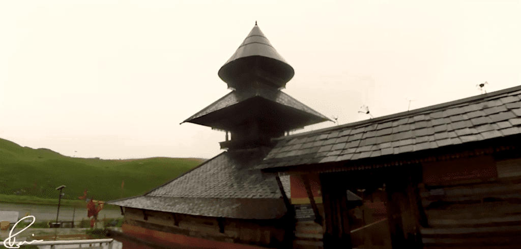
Not only does this mountain boast an abundance of natural beauty, but the secluded hilltop temple is a charming escape from the busy city. And also a great place to experience an overnight temple stay.
Heavy rain and poor visibility at Parashar Lake
Prashar Lake story
It is said that Sage Prashar pondered on the shores of this lake, which is why it is known as Prashar Lake. According to the legend, the lake was formed by Bhima, one of the Pandava brothers. As a result, Bheem (the strongest of the lot) smashed his elbow into one of the mountains, causing a large depression in the earth. Prashar Lake grew from this dent.
Is Prashar Lake Trek easy?
The Prashar Lake trip is 8 kilometers long and takes around 4 hours to complete. The path to Prashar Lake is surrounded by magnificent foliage, waterfalls, and little streams. Prashar Lake trek is a perfect family trek in Himachal and is ideal for beginners. Prashar Lake is accessible by road and you can take your car or bike all the way to Parashar lake.
Here’s the plan - How do I get to Prashar Lake?
We will rent a bike and ride along the river Beas. A right turn at Bajaura is where the narrow and less crowded, a road full of dangerous hairpin curves starts. The road will take you through some extreme landscapes, stream crossing, and some thick forest areas till you reach Prasar. On the next day, we explore the temple complex and return back to Manali.
The 2-wheeler uphill ride to Parashar Lake
Starting from Manali's pleasant stay with a splendid view from our hotel room, we’ll ride a motorbike all the way to Pasar lake. Along the way, we visited the Dechen Choekhor Buddhist Monastry monastery.
https://youtu.be/DuscLPcrzIY
As we had planned this trip during the monsoon, we were not sure of the view and the Prasar lake weather condition. The weather here cannot be predicted with apps as this is a mountainous region. We drove next to the Beas river till we reached Bajaura.
On reaching Kullu, we packed our bags with fruits and energy bars and enough fuel as there is no petrol station on the way. The ride was longer than we expected. The road is full of hairpin curves, narrow dangerous roads, breathtaking views. We stopped multiple times to enjoy the beauty around us.
Parashar lake hotel - The unexpected trouble
We reached late and it was dark and the weather changed drastically. To my surprise, the Himachal Tourism hotel stay that I had booked over the phone was given to someone else. And if you are looking for a Parashar lake hotel, other than the government guest house, you will not find any. But there are a few rooms available in the temple complex but poorly maintained.
There was no signal to call up anyone and luckily the temple staff helped in getting the permission to stay at the temple complex. Thanks to the temple staff who made sure we were comfortable and told us to stay till the weather is clear.
The rooms at the temple are strictly for pilgrims and we just had to pay for the pillow and bed which was available for rent. We had some snacks and a cup of hot tea in this cold weather at a shop in this temple complex at Parashar Lake. To end the first day we got a taste of the monastic life by staying overnight at the Prasar temple complex. It was a pleasant stay with minimal amenities.
The next morning, we were notified not to leave, by the temple staff as there were landslides on the way back, and crossing the stream was next to impossible. But, I had a different plan as we had booked 7 days Hampta Pass trek the next day. Check out my blog post starting from Trek to Jobra Campsite – Hampta Pass – Day 1.
Parashar Lake
After experiencing some morning temple rituals, we explored the place by walking around the temple. Our plan was to hike to the hill nearby and enjoy the view but bad weather and poor visibility made us stay indoors.
There is a floating landmass inside the lake, which is a common natural phenomenon all around the world. The floating land moves in all directions in the lake and covers 7% of the area of the lake. Prashar lake depth - It is said to be unclear how deep the lake is. The temple was built in the thirteenth century and legend has it was built by a baby from a single tree.
https://youtu.be/9hQfPe8aul8
Once it stopped raining, we went around the historic temple complex, got a closer look at the lake surroundings, and said goodbye to the temple staff. The visibility was poor even during noontime. We had our lunch on the way back at a local shop with whatever was available. The view was breathtaking. Parashar lake trek is a common weekend hike for locals in Himachal. And Parashar lake winter trek is famous for the snow-covered lake and mountains around.
Crossing the stream
We had multiple things to worry about on the way back. The 2 wheeler fuel meter was at the red or empty end, did not have information on where the landslides were, and also if we can cross the stream or not. We arrived at the stream, and it looked like the water level had come down. It was still an overcast day but had stopped raining. Crossing the stream all alone would have been difficult, with all my camera gear. Thanks to the locals who helped us in crossing the stream.
More troubles
We continued further with an eye on low fuel. We deliberately kept the engine off while riding or in neutral all the time as the ride was mostly downhill. There was one more blocker that we had. There was a huge traffic jam because of landslides and the bulldozers were at work blasting the stones. It took a few hours but as we had a motorbike. It was easy to cross in the narrow path while the work was still in progress.
Lessons learnt from Parashar Lake trip
There are a few things to learn if you are planning to go to this place. Get confirmation on your hotel or tent booking. Get a higher-powered bullet motorbike instead of a scooty, in our case, it was not available. And have an extra can of fuel. Also, it is better to avoid a trip to this place during monsoon and winter. The place can be too cold at night.
We finally managed to reach Kullu town where we refueled the motorbike and went further to Manali. Finishing the short pilgrimage ride at Manali with all the unexpected adventures, our trip comes to an end. From here on the next day, we opted to go for a weeklong hike to Hampta Pass.
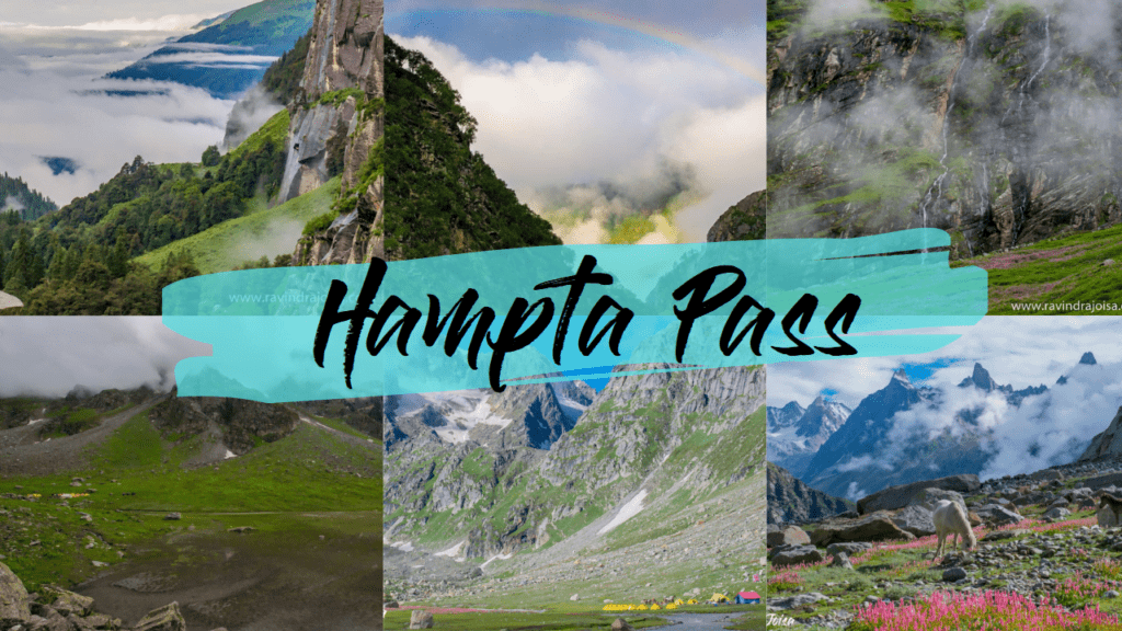
Hampta Pass trek. Photos by Ravindra Joisa
I hope you enjoyed reading this article. Join my Friendzone for some exclusive content. For more travel videos head over to my YouTube channel and consider subscribing. So, what is your travel experience? Leave a comment below.
In this region, you'll also come across a number of homestays. Kaza is the closest town. You may stay in hostels or hotels in Kaza and visit additional attractions such as the high-altitude post office and Key Monastery. You might want to consider staying in one of Kibber's homestays.
Ravindra at Kibber village, Spiti Valley, Himachal, India
Hiking to the Mount Kanamo basecamp
The Mount Kanamo trekking plan comprises staying at Kibber guesthouse for a day to acclimatize, hiking to Kanamo basecamp for a day, remaining at this campground for another day due to the high altitude, and beginning the summit ascent to the Kanamo peak early in the morning. If everything goes well and you don't get altitude sickness, you can return to Kibber the same day because it's all downhill.
You pass through vast fields of green peas and wheat shortly after leaving Kibber. The course begins with a hard incline and gradually levels out over the next three hours. The first view of Mount Kanamo, which stands at approximately 19,600 feet above sea level, can be seen here.
There is a flat stroll followed by a steady incline. You pass by a pond along the route, where we ate our packed lunch. The last two hours of the journey are the most exhausting, but they are also the most beautiful, with some breathtaking scenery. The first signs of altitude sickness appear here for hikers.
View from Mount Kanamo basecamp, the extreme terrain.
About Mount Kanamo Basecamp
Kanamo Basecamp (KBC) is located at a height of approximately 16000 feet. Spend another day or two after arriving at the campground to acclimate to the increased altitude. Later that day, it was raining outside with severe lighting and thunderstorms, so we stayed inside the tent. This is the final location you'll come across a water supply. Even animals in the wild visit this location to drink water. The view of the surrounding area is spectacular. The perspective demonstrates how rough, wild, and severe the environment is. Many other Himalayan hikes are also popular in the area.
Mount Kanamo basecamp
Wildlife at Mount Kanamo basecamp
We were fortunate enough to observe a rainbow and a few rare Himalayan wild creatures, which I documented on Instagram. Because the area is part of the Kibber wildlife sanctuary, any type of campfire or hunting is prohibited. Himalayan Yaks and Himalayan Ibex are among the animals. Snow leopards are more likely to be seen if you travel farther away from this location, towards the glacier or the other side of Mount Kanamo. These creatures are afraid of humans, and we must be careful not to disturb them in any manner.
The walk from Kibber to Mount Kanamo basecamp was that long. Because this area is a wildlife protection zone, don't be shocked if trekking is prohibited after you arrive. Consult the locals. It's important to note that this is a summit climb, not an ordinary trek. We attempted to summit Kanamo Peak after spending a day at Kanamo base camp. You may get a sense of the path by watching my YouTube video below. I hope you enjoyed seeing the film, and in the next video, I'll tell you about my effort at Kanamo Peak. Thank you for watching, and please consider subscribing.
https://youtu.be/0s2fmpV-8KY
You might also want to watch my Hampta Pass trek blog posts or Kashmir Great Lakes and many more. For more stories of this kind join my friendzone and you can buy me a coffee to support my work. Also, consider subscribing to my YouTube channel.
The second day of the Hampta Pass hike from Jobra to Jwara is a paradise. The most beautiful scenery, waterfall, flower bed, hiking trail right next to the stream, between the boulders, and icy-cold stream crossing. Furthermore, a lovely campground where clouds and fog play hide-and-seek with ice-clad mountains. A paradise for nature lovers.
The golden hours at Jobra campsite, in the evening and early morning, are ideal hours for photographers to get some amazing shots. The campsite at Jobra is just before the wooden bridge. Trekkers usually spend their time enjoying the view where they had come from on the previous day or next to this wooden bridge. 'Rani Nalla', the stream nearby is the main source of water at this campsite.
The first half of the trail
Jobra Campsite - Wooden Bridge - Rani Nalla
Day 2 of the trek starts from this wooden bridge and is almost a flat walk in the meadows, followed by a gradual climb uphill. This is where the trail gets narrower. The entire trail to the Jwara campsite is right next to the Rani Nalla. The trail is full of boulders and unnamed seasonal waterfalls.
Waterfall in the Hampta Pass Trail near Jobra
The ideal time to visit this place is during the monsoon when you get too many small waterfalls. Also, less snow in the lower region. During monsoon, you may expect snow only near the Hampta Pass and you may find a snow patch on the way up. In addition, as you walk along the banks of the Rani Nalla, you get to see the Maple and Pine forests around.
The tricky place
Jwara campsite - Tunnel View - Hampta Pass trek
The trail is slippery and right next to the stream. The trail is narrow, full of huge boulders, and can be tricky in some places. There is one place where you are directly under the waterfall. The view is breathtaking and you get to see wild horse grazing and also if you are lucky you even get to see vultures.
Rainbow and the tunnel view
Once you reach the top of the stream is where the final adventure of the day begins. To reach the Jwara campsite, the crossing of the ice-cold stream is a must. Be prepared for a slow crossing in this ice-cold water as the stream is full of sharp stones. In addition, the current and water level might be higher. You may even find a tent where they sell toffees, biscuits, maggie, and cold drinks, but cannot be guaranteed.
Where to camp in Jwara
Jwara campsite - Hampta Pass Trek
Once you cross the stream, the trail is a 20-degree gradual ascent to the Jwara campsite. The trail is full of wildflowers and meadows. If you look back at the trail that you had just covered, the view appears more like a tunnel where dramatic cloud movements are seen. Therefore, an ideal place to get some timelapse videos.
Meadows and wildflowers - Hampta Pass trek
Meanwhile, you may want to watch the YouTube video below where I have made some timelapse of this location. A few meters further is the Jwara campsite. In the evening, you may visit the nearby waterfall and go on handpicking wild strawberries.
To conclude, the day is full of adventure and a short hike - with too many waterfalls, a slippery trail full of boulders, stream crossing. In addition, check out my YouTube video, and do not forget to subscribe to my YouTube channel and to follow me on Instagram - @ravindra_joisa. Also, check out the remaining days of the trek by clicking here.
A place that is known for its natural wonder, the unique pattern formed by the erosion of Navajo Sandstone due to flash flood. In addition, the place attracts thousands of visitors every year and is best known for photographers to visit during noontime. It is the Lower Antelope located in Page, Arizona, US.
If you are in Arizona or in Vegas then consider visiting this place. An early morning five hours drive from Vegas will take you to Antelope Canyon. However, there are many tour operators you can opt for who can take you to this place. Lower Antelope is located in the Navajo Nation Parks. So, antelope canyon is a national park. The nearest airport to Antelope Canyon is Page (PGA) Airport which is 2.1 miles away. Other nearby airports include Cedar City (CDC) (105.1 miles) and St George (SGU) (119.7 miles).
What's near antelope canyon
Other places to visit on the way include Horseshoe Bend, Glen Canyon Dam, Navajo Village Heritage Center, Powell Museum. Note that you need to cross the Glen Canyon Dam bridge. Also, you may even visit the Upper Antelope Canyon.
Lower Antelope Canyon has copper-colored walls, full of natural patterns that have formed over the years. As you start walking through the canyon floor's chalky gold dust, gentle curving lines in the rock creates an illusion of waves, swirling around us in a flood of color. Reds, oranges, pinks, and blues dance, with the sun's rays and shadow, adding drama to an already striking location.
Lower Antelope Canyon is full of narrow passageways to squeeze through and ladders to climb. Also, the narrow walls at the bottom, twisting and turning their way through the canyon, with the natural design patterns is a lovely walk-through, sometimes even scary. The place is famous for some of the iconic national geographic photos. In some places, the rock carvings and formation appear more like a human face, shark face, etc.
Why is antelope canyon red
Periodic rains sculpted Antelope Canyon out of the rock. Aeolian deposition generated Navajo sandstone between 191 and 174 million years ago. Since then, iron oxides have been deposited in various concentrations on some of the sand grains, giving the slot canyon layers upon layers of varied shades of red.
Antelope Canyon got its name from Navajo legends about antelopes grazing along the canyon during the winter. The Navajo people call the Upper Canyon "Tse' bighanilini." In English, this means "the location where water rushes between rocks."
What I did not like
The man-made stairs in this beautiful place are made for visitors. Spoiling nature's artwork with the drill holes, screws, nuts, and bolts is not something that I like. The place is overcrowded most of the time. Also, this place is not something where you can go solo but you will have to go with a guide.
The place is scary when you get to see the depth and hear the flash flood stories. Antelope Canyon remains closed once in a while for the same reason. In addition, the entry ticket to this place is overpriced at 50-60 USD. If you are allergic to sand then this is not the place to visit. Note that it is a place to do some photoshoots but tripods are not allowed and as it is a crowded place it is hard to spend even a minute more in one place.
To conclude, this is a beautiful place to visit if Antelope Canyon is on the way to your destination. But, if you dedicate a trip only to this place, then it is not worth it considering the time it takes to reach this crowded place. In my case, it was a tour organized by tour operators from Vegas. Similarly, we have the Upper Antelope Canyon which is similar and good to visit in the morning at around 10:30 to see the sunbeams. Note that these canyons are not pet-friendly.
https://youtu.be/ZhsZ5COb9cg
If you like this blog post then consider joining the friendzone. Also, subscribe to my YouTube channel where I share videos on travel and photography.
The Land of Thunder Dragon in the Himalayas, Bhutan is a heavenly place to visit. A country that gives priority to the happiness index. In addition, this country is full of stupas, Buddhist monasteries, and artwork. So, expect all the places to be tranquil and serener. But, there is one less known and unique monastery by the name Chimi Lhakhang, with a lot of penises around. Yeah, you heard that right.
It is well-known across Bhutan as a fertility-inducing location for all guests who come here hoping to have a kid. Several pilgrims, particularly newlywed couples, come here to seek the blessings of the saint who is reputed to possess the Magical Thunderbolt Of Wisdom.
Chimi Lhakhang, located in the Punakha requires district-level permission. However, a tourist guide will help you with the necessary permissions. The fee is per day stay in Bhutan and can be super expensive for outsiders other than a few countries in the Indian subcontinent and a guide is a must.
Where Chimi Lhakhang located?
Chimi Lhakhang is on the way to Punakha Dzong. It is just over 100 kilometers from Paro and 65 kilometers from Thimphu. But it takes 2-3 hours to drive in the mountains. Meanwhile, reaching the Chimi Lhakhang monastery from the highway is an approx one-kilometer hike. The hike is scenic, crossing the paddy fields, via the Yowakha village full of handicraft stores, paintings, and prayer flags. Also, the hike can be even more picturesque if you take the back entrance, next to the Puna Tsang Chu river.
Chimi Lhakhang monastery is no different from other monasteries, it just has a lot more penises. This monastery also known as the Fertility temple was originally built back in 1499 AD on a short hill. This penis-focused monastery is dedicated to Buddhism's "Divine Madman". In addition, he was 'the monk of 5000 women', his unorthodox ways of teaching Buddhism by singing, humor, and outrageous behavior, was shocking and with sexual overtones. Women who come to the temple in the hopes of conceiving are forced to carry a wooden phallus around the temple three times.
Who built the Chimi Lhakhang?
Chimi Lhakhang, also known as the Chimi Monastery or Temple, is a Buddhist monastery in Punakha District, Bhutan, near Lobesa. It was erected by the 14th Drukpa hierarch, Ngawang Choegyel after the land was blessed by the Divine Madman, the maverick saint Drukpa Kunley.
Divine Madman is also the saint who advocated the use of phallus symbols as paintings on walls and as flying carved wooden phalluses on house tops at four corners of the eaves. The monastery is the repository of the original wooden symbol of the phallus. The wooden phallus has a silver handle as decoration. People are blessed with the wooden phallus, who visit the monastery on pilgrimage, particularly women seeking blessings to beget children. More on inside the temple structure and tradition refer to the wiki.
About 15 minutes drive from Chimi Lhakhang is the beautiful Punakha Dzong, where the royal wedding takes place. Therefore, for tourists, this is a must-visit place. After that, a kilometer drive from here is a beautiful campsite where you can stay overnight, right next to the river. Also, on the other side of Punakha Dzong is the Punakha Pho Chhu suspension bridge. However, vehicles are not allowed on top of this bridge. Cross the bridge and have some local tea on the other side of the river in a traditional style.
To conclude, a visit to this place is unique, if you consider all the images that are put up in each and every house. Also, considering the story you get to hear of the divine madman. Above all, as this is a fertility temple, people from all around the world visit this place hoping to get the blessings to beget children. Also, do not forget to visit one of the local handicraft stores on the way to this temple. Even the world-famous Thangka paintings (more details) are available. Check out the YouTube video below and please consider subscribing to my YouTube channel.