Thangka painting has its origins in Tibetian Buddhist paintings. These paintings are made in Bhutan, Nepal, Tibet, and India. Thangka paintings are made on cotton, silk, and human skin depicting the 'mandala' (Mandala in Sanskrit means is a spiritual and ritual symbol representing the universe). Thangka paintings usually represent the life of Buddha.
The painting takes a few months to complete. An artist completing his painting work.
The Thangka Painting Gallery
There are multiple Thangka painting galleries in Bhutan and Nepal. I visited one of these galleries. The place is located next to an ancient paper mill in Thimphu town. The 'Thangkha Painting Gallery' is a school for many who want to learn as well as this place has some of the incredible paintings in the display room.
Visitors are not allowed to record or capture the final paintings. With permission, I managed to get the video and photos of those people who were working at this gallery. Thanks to the friendly staff. The gallery has paintings, craftworks, dragon masks, cloth items. The staff explained to us how it is made, the colors used, when and where it is used, etc.
The Thangka Painting Gallery. We were denied photographing the finished products which are inside the main gallery.
How is Thangka Painting made?
The detailed work, the amount of time and training involved in doing each of these paintings astonished me. It takes more than 6-9 years to master this painting work. Each of these paintings takes almost 1 year of work to complete. No wonder why these paintings are so expensive. The size of each of these paintings varies from A4 size to huge paintings, which are displayed in Monasteries during rituals or ceremonies.
Check out the video below where you can see the Thangka Painting gallery which is in Thimphu and people are busy with their artwork. These Thangka Paintings are super expensive and can easily cost 1000s of American US dollars. I have found a few online which is inexpensive but are equally good, ideal for home decor.
Most of the Thangka paintings are traditionally kept unframed and rolled up when not on display. These paintings are made of natural color and are very delicate, have to be kept away from moisture. These paintings depict the life of Buddha, mantras, various influential lamas, the visual representation of the art of enlightenment, etc.
https://youtu.be/wicAdpMcENw
At this art gallery, you will find professional artists painting with natural colors. Also, there are other handmade crafts, like the mask used in festivals where they perform the mask dance.
Traditional Paper Mill
Also, if you go a little further outside of this gallery, you will find the old traditional way of making paper. These traditional ways of making take time and money and this is the only mill that is present as of today. The papers are mainly used for artwork, paintings, manuscripts. The paintings and manuscripts are kept available for sale at this art gallery. Also, you get notebooks made of these papers which is expensive.
In short, these paintings are beautiful. A close-up view of these paintings will show you the kind of effort that has gone into the making of each of these masterpieces. No wonder the finished product is so expensive considering the training it takes to make this, the natural colors, and most importantly the time it takes to complete just one painting.
If you enjoyed reading this content then you can buy me a coffee to support my work or buy some of my photos from my store. Also, join my friendzone and signup for my newsletter.
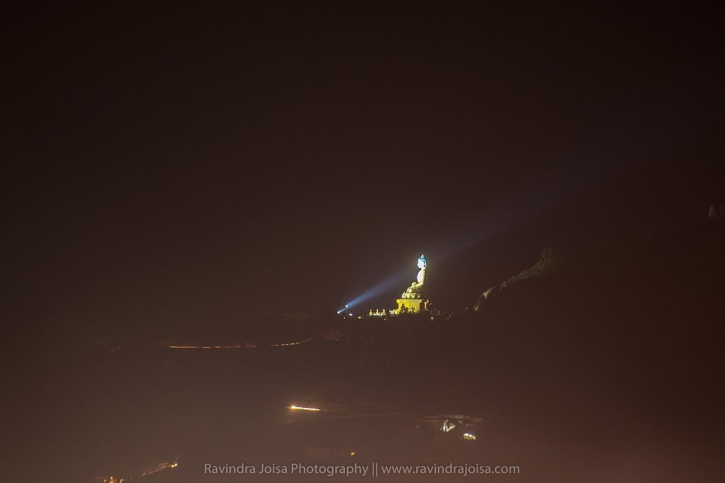
The world's largest mountaintop statue of Buddha Dordenma is located in the western parts of Bhutan, Thimphu. A must-visit place if you are in Thimphu. The huge structure of Buddha (Shakyamuni) is made of bronze and is gilded in gold. The view from here is breathtaking as it overlooks the southern entrance to Thimphu valley. Also, this mega-structure of Buddha Dordenma is located atop a hill in Kuenselphodrang Nature Park, Thimphu, the capital of Bhutan.
About the statue of Buddha Dordenma
The statue of Buddha Dordenma is 169 feet (51.5 meters) high. Within this megastructure are 125,000 smaller Buddha statues. Of this, 100,000 are 8 inches tall and 25,000 are inches tall. The statue of Buddha Dordenma is on top of a large meditation hall.
Two prophesies are fulfilled by the monument as well. The first, as predicted by yogi Sonam Sangpo, is the construction of a Buddhist statue in the area to "bestow blessings, peace, and happiness on the whole globe." Furthermore, Guru Padmasambhava, sometimes known as the "second Buddha," is supposed to have described the statue in the seventh century. By fulfilling both prophesies in a gleaming manner, this statue kills two birds with one stone.
Who built Buddha Dordenma in Bhutan?
This is a brand new structure that was built recently. The statue was built at a cost of US$47 million by Aerosun Corporation of Nanjing, China, and was financed by Singaporean billionaire Rinchen Peter Teo. The overall cost of the project exceeds US$100 million. These hundreds of smaller Buddhas, like the giant Buddha, are plated and made of bronze, which is one of the reasons the statue cost about $100 million to create when it was built in 2015 to commemorate the 60th birthday of Jigme Singye Wangchuck, Bhutan's fourth monarch.
Where is the Buddha statue located?
The drive to this location is scenic. To reach this place from Thimphu, you can drive to the backside of the structure or park in front, but there is a staircase all the way up from the main entrance. Once you climb the stairs, the open space is big enough to accommodate a few thousand. The statue of Buddha Dordenma is sited amidst the ruins of Kuensel Phodrang, the palace of Sherab Wangchuck, the 13th Desi Druk. I would recommend going in the evening to enjoy the view from the top.
The ideal time to visit would be during summer in Bhutan for those who do not like snowfall. Firstly, this new structure is a must-visit place in Thimphu. Secondly, the lighting at night and the view is from far off, is breathtaking.
Zoomed in view from Thimphu
Other places to visit in Thimphu
When you are in Thimphu consider visiting the beautiful Dzong, Thangka painting and art gallery, and National Memorial Chorten. Also, there is a Scottish cafe with some best snacks. We spent some time here in this cafe on a cold night and was a wonderful experience.
For more information, you may visit the Bhutan Tourism website or buy a copy of the Lonely Planet Bhutan book which has all the required information on hotels to stay, cafes, places to visit in detail. Hope you enjoyed reading this blog post. Buy me a coffee to support my work or you can go to my store to buy some of my images. Also, do not forget to join my FriendZone by signing up for my newsletter.
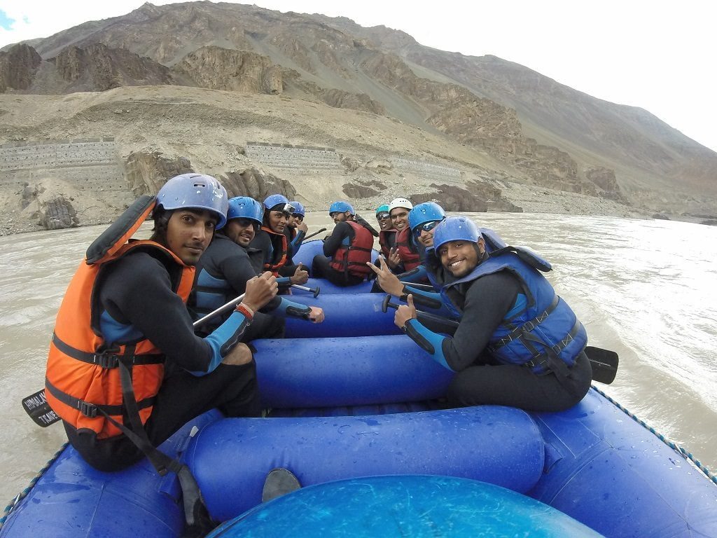
The Zanskar river rafting is the most difficult high altitude, highest in the world, and the second most difficult in India. If you're in Leh, this is a must-do adventurous excursion. The Zanskar River is famed for the famous 'Chadar Trek' (frozen river) that takes place during the winter when temperatures drop to minus 30 degrees Celsius. During the summer, the same river is popular for river rafting.
In the 24-kilometer section of the Zanskar River, there are around twelve rapids and a few whirlpools. There is a shorter, gentler one that is 8-12 kilometers long and has only 3 or 4 rapids. The lengthier one is full of excitement and adventure. Zanskar river rafting is high-altitude rafting at an altitude of more than 11,000 feet, making it the highest in the world. Ascertain that you are acclimatized to this altitude. You may do this by remaining in Leh for two days and doing nothing. After the Brahmaputra, the Zanskar river rafting is the second most difficult in India, with a grade 4 level.
Where can I go rafting in Leh?
The site is on the Leh - Kargil route, near Ladakh Union Territory. Leh is the nearest airport. The organizers' actual site is the Sangam, where the Zanskar and Indus rivers merge to form the Indus River. Zanskar is a tributary of the Indus River that flows north.
zanskar river rafting starting point
Prepare at the campground, which is near National Highway One, with the swimsuit/cold water jacket that they give, as well as the life jackets and helmets. The organizers will transport you to the starting spot, which is roughly 24 kilometers away. The journey to this location is full of adventure, with severe hairpin corners, landslides, no asphalt road in a few spots, and no road railing - one bad move by the driver, and you'll be all the way down in the Zanskar river. The coolest part is that you can stand on the backside of the vehicle. You can see this in the video below.
The Zanskar river rafting
The river rafting adventure begins with a set of instructions and a brief warm-up on how to paddle and so on. The Rapids begins almost instantly. Some of the most hazardous areas at the start and in the middle. After roughly 30 minutes from the start, there is a little pause. After the break, there are a few additional rapids, followed by a whirlpool near the bridge. After we cross the bridge, the remaining few kilometers are completely flat. The entire travel took about an hour. The water is ice cold, and you can even dive near the tent at the further end.
Is Zanskar river rafting safe?
Rafting may also be done on the Zanskar river's rapids. Because the rivers include rapids ranging from level 1 to level 4, you may select the rapid based on the amount of difficulty you are ready to tackle. Rafting in Leh is a safe activity that can be enjoyed with an open mind and an enthusiastic heart.
What is the price of river rafting?
The Zanskar river rafting price package costs between 1,000 and 1,500 rupees and includes 24-kilometer travel to the starting location in a jeep or minibus, a swimsuit to protect you from the chilly water, a safety jacket, a guide and instruction expenses, permission, boat, and lunch. The costs of the action camera are an additional 1000 rupees. I recommend bringing your own action camera with a head mount with you.
Zanskar river rafting Safety
Instructions will be given at the start, as well as a guide in the boat while rafting, another guide who will kayak alongside us for the duration of the adventure, a safety jacket, cold water suit, helmet, and a jeep that will follow us on the road that runs along to the Zanskar river. The guides are certified and trained in Rishikesh, another popular river rafting destination in India.
Hope you enjoyed reading this blog post. Buy me a coffee to support my work or you can go to my store to buy some of my images. Also, do not forget to join my FriendZone by signing up for my newsletter. Check out the video below and subscribe to my YouTube channel for more travel and adventure stories.
The cityscape image of buildings and city traffic that you see here is from the outer ring road at Bangalore City in India, usually crowded and full of traffic during daytime. The same place at night looks completely different after sunset. The images captured at dusk adds mood and extra dimension to the image.
Outer Ring Road, Mahadevapura, Bangalore, India
Here are few things that you might want to consider while capturing cityscape at dusk:
Capturing cityscape during nightfall requires a sturdy tripod. Read more on Tripod here as Tripod is a must if you want to master low light photography. The free tripod that you get along with the camera is good for your mobile phone or a point and shoot camera and not for your DSLR. I recommend a carbon fiber tripod.
Wireless or shutter cable release is a must. This is basically to avoid any kind of camera shake. Also, make sure to tie the camera strap to avoid any kind of movement.
A lens with aperture going up to f2.8 will be helpful. Preferably, use 14-24mm f2.8 lens or 50mm f1.4 lens. Wide aperture will allow more light to enter the sensor and hence better image. Higher aperture will allow less light and your camera will auto increase ISO to compensate when in auto mode. This will only add grains or noise when you do photography at night.
Albert Hall Museum, Jaipur, India
The first 30-45 minutes after sunset (or golden hours) is the ideal time to capture photos. You can even get some amazing cloudscape that is golden colored and trust me, that looks amazing. Checkout my blog post - Capture Cloud movement using ND Filter to know more.
The street light (usually the sodium vapor lamp, incandescent) will be a dominant light source during this time. These days (in India) sodium lights are being replaced by the LED lights and you might need to adjust the kelvin value accordingly.
If it is too dark then make sure, fill the frame with well-lit objects. Indirect light source, long exposure, wide aperture can solve the problem of low light photography without increasing the ISO.
Rinpung Dzong, Paro, Bhutan
Capture in RAW format so that you can edit later. Always, prefer the RAW format as it will capture all the colors and can be recovered while editing. If you capture in JPEG which is a compressed format, it cannot be recovered.
Do not increase the ISO to max unless needed as it might add noise, instead, lower the aperture close to f2.8 or lower and increase the shutter. These days the cameras are good and increasing ISO will not add much noise. Noise will matter only if you want to see images or for professional use. It doesn't really matter for social media usage.
While editing, increase the shadows and decrease the highlights. You can do this and recover details from highlights and shadows, provided the image is captured in RAW format.
https://youtu.be/W3cjh8ApMi4
These are some of the basic rules that you need to follow which are simple, to get the best out of your camera. You need not have an expensive f2.8 lens to capture this. Just practice more to get the best out of your camera. Check out the time-lapse of Bangalore cityscape. Each frame in this time-lapse video is a long exposure shot captured for a certain period of time. Watch the video in HD for better quality.
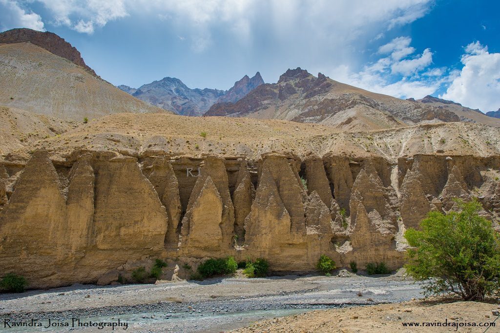
Our stay at a guest home beside the creek in Shakar was fantastic. We toured the area and began cycling on the Khangral-Sanjak route, passing through tiny villages until we reached National Highway One. The surrounding countryside is stunning, resembling a high-contrast picture. Because the area is so unique, soil erosion creates unique structures that have been unspoiled by people. The mountains in the backdrop, the green area in the middle, and the river in the front all appear to be from our elementary school painting class textbooks. On day 4, we traveled 38 kilometers from Shakar 2 to Haniskot.
Shakar is a lovely campground located near a brook that flows into the Indus. We stayed in an under-construction government guest house named the Tourist Facilitation Centre and spent the evening touring the campground and the surrounding Shakar market road hamlet. It is frequently chilly at night, making it a great location for a bonfire. Investigate the communities in and around Shakar. Try something different in Shakar, such as butter tea or local bread, and stay in one of their houses; after all, it is a one-of-a-kind experience. Make friends with the locals; they can be fantastic portrait subjects if you enjoy portrait photography or wish to film a documentary.
Khangral - Sanjak road
Cross the river across the bridge and continue on the Khangral-Sanjak route we took on day three. As we ride through villages and fields, there are several stores. We get to travel through the green patches and agricultural regions adjacent to the river and the dark multi-hued brown mountain peaks. Continue cycling up and down the mountain, following the Khangral-Sanjak route until you reach National Highway One at Khangral. Take a left at this crossroads, which will lead you to Leh. The road to the right will lead you to Kargil and Srinagar.
Stay at Haniskot
The most picturesque path is to the left. There are a few little stores along the road where you may stop and enjoy the scenery. Continue cycling till you reach Haniskot, another gorgeous location. Cycling here isn't difficult; just a few ups and downs might be difficult in the sweltering midday sun. Take a rest at one of the surrounding stores on your trip to Haniskot. The scenery is stunning, and it's an excellent location for taking photographs. Finally, we remained at the government bungalow/guest house, which was conveniently located adjacent to the highway.
A visit to remote village Kanji
A kilometer from this bungalow is a road to the right that takes you to a place named Kanji which is about 12 kilometers from the junction. The journey to this location is beautiful. The YHAI itinerary does not include a visit to Kanji. We arrived at Haniskot much early, and it was up to us to explore. A few of us who had the energy went a little further. The entire distance between Kanji and Tokyo is around 26 kilometers.
Nowadays, the majority of photographers record photographs in RAW format. Taking photos in RAW format provides advantages over taking photos in JPEG format. Most DSLRs and powerful compact cameras have the ability to take photographs in RAW format (.NEF format in Nikon, CRII format in Canon, etc). RAW images are frequently referred to as digital negatives.
Importance of capturing in RAW format
When photographs are recorded in JPEG format, the color information is compressed by the camera's built-in software (permanent loss of color information in an image). The JPEG image has around 250 odd color information, but the RAW image contains several thousand color information.
The photographer then downloads the RAW photographs from the memory card. The image is then tweaked to get the desired white balance, contrast, exposure, saturation, color, sharpness, lens correction, and so on. One of the most recent additions is the 'Dehaze' option in Lightroom when editing, which is quite handy. The ultimate output of a picture is determined not only by the image that is acquired but also by the editing abilities of the user.
It is worth noting that the size of a RAW format image is significantly larger, nearly double that of a high-quality JPEG image. The size of the JPEG image is determined by the type of JPEG format used while capturing the image.
When do I capture images in RAW format and in JPEG?
Whenever I am on a photo assignment, project, paid photo shoot, photos that I plan to sell; I make sure that the images are always captured in RAW format.
The not so important, casual shots of known and unknown friends, unpaid work is something that I prefer to capture in JPEG.
My memory card was almost full. It happened to me during one of my Himalayan treks and I will not be traveling to that place again (as I have many more places to cover). My memory card was almost full and If I were to capture images in RAW format, it would almost double the space. I had two options - either to continue capturing images in RAW format and ignore the important shots later in the trekking trail or capture in JPEG (which takes half the space) and capture all the photos. I opted for the second.
If you are lazy and fine with JPEG quality and with what your camera has captured, then go ahead with JPEG.
Go for JPEG if you don't want to edit an image.
I have seen some of the photojournalists/war photographers capturing images in JPEG, where one of the conditions is not to edit images and the images are to be delivered in no time.
Surathkal NITK Beach, Copyright: Ravindra Joisa
Here's an example: in the above image, the foreground seemed dark and was subsequently modified by raising the shadows to be in details. The same is true for the backdrop sky, which was blown out in the original photograph. However, because it was captured in RAW format, I was able to retrieve the information from the sky region by reducing the shadows. You may do the same with JPEG photos, but the image quality suffers as a result. It will also be unsuitable for professional use. Note that the above image was captured after the sunset and the actual image appeared dark.
How to edit RAW format images?
The RAW format image always appears dull and is an incomplete image. It has to be processed using a photo editing software like Adobe Lightroom or Photoshop or other image editing software. Note that the RAW format images are not supported by the websites and has to be converted to JPEG or PNG format. I would highly recommend to super compress if it is for websites so that the image can load fast. By the way, you can go through my courses to know more on how to edit using Lightroom.
Subscribe to my blog and Youtube channel. Hope you enjoyed reading this blog post. Buy me a coffee to support my work or you can go to my store to buy some of my images. Also, do not forget to join my FriendZone by signing up for my newsletter.
Here is my interview with Unnati Sagar from 'Smart Photography Magazine' on travel and landscape photography. Most of the images that were published were from my Himalayan treks and Bhutan trip. The interview was published in the April 2017 edition.
About Smart Photography Magazine
Smart Photography is a well-known photography magazine that discusses photography ideas, techniques, interviews with professional photographers, the newest camera and associated devices, photography contests, and so on. The magazine is well-known in India, and they select photographers based solely on their photographic work. In my situation, Smart Photography has provided me with a platform to showcase my work. Many amateur photographers have been given the opportunity to showcase their work and become well-known.
My interview and photos that were published
Smart photography magazine has selected carefully some of my best images and here are a few. Images: from Bhutan - The place of great happiness - Punakha Dzong and inside the second courtyard of Punakha Dzong.
Bhutan is a separate cultural and natural entity. Perched high in the Himalayas, it is the world's last surviving Buddhist monarchy. It has created the Gross National Happiness concept, according to which development is measured using a holistic approach to well-being rather than just GDP. The kingdom's primary sources of revenue are tourism, hydroelectric power, and agriculture. There are numerous locations to visit in Bhutan, but if you are on a budget and just have a few days, these are the top ten places to see in Bhutan.
Images: View from Dochula Pass, Bhutan, and Tashichho, Thimpu, Bhutan.
Images: Captured this next to our campsite on day 2 during our Aru to Lidderwat trek and the second picture is of Bodhi tree inside the first courtyard of Punakha Dzong, Bhutan. Also, read complete details with photos and videos on the Tarsar trek here.
Tarsar Lake, one of India's most beautiful lakes, is a nature lover's heaven. Untouched, pure, crystal clear water, breathtaking scenery, no human activity around, and an ideal location for solitary meditation. Even the natives regard the water of Tarsar Lake as sacred. A fantastic location for camping, scenery photography, and night photography to capture the Milky Way and star trails. This lake is over a kilometre long and nearly a kilometre broad. The view from the neighbouring pass is spectacular.
Image: Surathkal Beach, Mangalore, India. This is a long exposure shot. To know more about long exposure shots, check out my previous article - controlling the picture-taking process. The second image is from Lidderwat, Jammu, and Kashmir, India.
Image: Aru, on the way to Lidderwat, Tarsar trek, Jammu, and Kashmir, India.
Kuduremukh, Western Ghats, Karnataka, India - Read complete details on the Kuduremukh trek here.
If you're in Bangalore, the Kudremukh hike is a must-see for its breathtaking landscape. This is a circular trip that entails crossing more than ten creeks as well as extensive grasslands. Kudremukh is Kannada for "horse's face." The summit's distinctive shape prompted its name. Because it was accessible from Samse village, this was formerly known as Samseparvath. Kudremukh lies in the district of Chikkamagaluru, in the heart of the Western Ghats. It is part of the Kudremukh National Park, the western ghats' second-largest wildlife sanctuary.
Image: Capture this amazing landscape at noon during my visit to Key Monastery in Spiti, Himachal Pradesh, India. The second image is from Naranag forest, my last day of the Kashmir Great Lakes trek. Check out this link to know more about Narang forest.
Image: I had high altitude sickness and did not climb further. Instead, spent two days at Kanamo base camp capturing some amazing shots of landscape and wild animals.
Special thanks to Smart Photography magazine for the interview and for publishing the same in the magazine. To know more details on this, download the legal magazine copy from the Smart Photography website mentioned above or from the Jio magazine app.
Follow me on social media and subscribe to my blog for more updates on travel and photography. Also, subscribe to my Youtube channel for more videos and travel stories.
Day three of our cycling, from Skurbuchan to Shakar was another exciting one. Cycling next to the Indus river on Indus valley road, the amazing landscape, cycling through the apricot farmland, river crossing, cycling next to the stream, cycling downhill and extremely tiring uphill followed by camping next to the stream.
If you are traveling solo to this beautiful remote village in Skurbuchan then you might want to consider staying at homestays at Aryan valley. There are places where you can camp and on the way you will find small shops where some of the rations are available which is good enough if you are planning to camp. Also, there is a government guesthouse. Watch this video below to know more.
About Skurbuchan
Skurbuchan village is located above the Indus in western Ladakh, approximately 125 kilometers from Leh. The name of the settlement comes from a native fruit called 'Skyur,' which is exclusively cultivated in and near the village. The village, with a population of over 2000 people, is one of the largest in the region. Beautiful river streams, lush green meadows, and delightful walks make this settlement a perfect addition to any Ladakh itinerary. The settlement boasts a big Buddha statue on a mountaintop overlooking the entire village, from where you can admire the grandeur of Skurbuchan. Skurbuchan is also significant as the entryway to the well-known Aryan communities.
Skur Buchan to Shakar
At Skurbuchan campsite, enjoy the morning walk around the apricot farm and the local village. Have breakfast, pack your bags, and check for tire pressure before cycling. Take the mud route till you reach the main road. The route is mainly flat or downhill next to the river Indus, crossing a few villages. It is a long ride with hardly any water source.
The river water is all silt and cannot be used for drinking. It is dangerous to get all the way down to the river and also, the rapid flow of water, doesn't make this a safe place to get to the water. It is hard to find any shop on the way and we stopped at Indus cafe for a small tea break which is just before the Sanjak bridge.
Places to visit in Skurbuchan
When you go on a cycling expedition, it may not be possible to cover all the places as you need to stick on to the time and the scheduled plan. With YHAI it is strict and you cannot deviate from the plan unless you have approval from your guide, else you may be out of the expedition. But, if you are going solo which I recommend, or if you are on a casual vacation visiting on your own then you might want to consider visiting Buddha Statue, Skurbuchan Monastery, Indus River, Dah, and Hanu (Aryan Villages).
Sanjak Bridge - Crossing the river Indus
Continue to pedal further till you reach a bridge that takes you to a village. The route from this place to our campsite is all uphill and is extremely tiring. We managed to pedal switching between first and second gear, with multiple breaks till we reached the next village. We had packed lunch and explored the place and had some fresh juicy apricot.
Post lunch we continued further uphill, but not too steep, next to steam. The landscape here isn't too dry and is full of trees and farmland. After cycling for almost 2 hours we crossed the stream and stayed at an under-construction government guest house. It was almost dark and we spent some time next to the stream. The place is now called the Tourist facilitation center, where you will have an option to stay. Also, just outside this place, you can even camp adjacent to the facilitation center on the river bank.
If you are planning a trip to Bhutan and want to go from Phuentsholing to Paro, you should read this blog post. Phuentsholing, the doorway to the world of thunder dragons, is frequently recognized as the residence of the Himalayan Kingdom's kings and queens. Time flows slowly here, and the simplicity of the people compliments the peacefulness of nature. On the Himalayan foothills, this Bhutanese commercial hub is near the Indian town of Jaigaon. In Phuentsholing, there are a lot of places to visit where you can see the diversity of Bhutanese, Nepalese, and Indian cultures.
How to reach Phuentsholing Bhutan
If you are coming from India, you have two alternatives for traveling to Paro: through Phuentsholing or directly to Paro. It's worth mentioning that, as of this writing, if you're an Indian citizen, you don't require a visa. All you want is proof of Indian citizenship. In addition, if you are not an Indian, you may choose to travel directly to Paro.
For starters, a flight from Mumbai to Paro is more expensive. If you are flying from Bangalore to Bhutan, the best option is to travel directly to Bagdogra, West Bengal. Although daily flights are available, I do not recommend going through Delhi. Second, after arriving in Bagdogra, take a shared cab to Phuentsholing. The travel will take between 4 and 5 hours. The India-Bhutan border crossing is open during the day but closes at 8:30 p.m. One of the hotels in Phuentsholing after crossing the border. Phuentsholing hotels are reasonably priced and plentiful, as this is the commerce center between the two nations.
I raced to the visa office the next morning which is in the town center. Even though Indians do not need a visa to enter Bhutan, we must obtain authorization and show various authentic documents, such as passports. Prepare a few photocopies and xerox copies. It will take a few hours for the approval to reach two locations. While others snacked, we proceeded to "Zangtopelri," which I suppose is a temple. It should be noted that, according to current updates, Indian tourists are paid an admission fee, but it is significantly cheaper than in other nations.
Places To Visit In Phuentsholing
If you have a day or two to spare then consider visiting the following places.
Bhutan Gate
Amo Chhu Crocodile Breeding Centre
Zangto Pelri Lhakhang
Zangto Pelri Park
Karbandi Monastery
Torsa River Side
Phuentsholing Market
Phuentsholing Viewpoint
Phuentsholing Park
Palden Tashi Chholing Shedra
Phuentsholing to Paro
We stashed our luggage and boarded a minibus bound for Paro from Phuentsholing. The entire explanation may be seen in the video below. Our permits were checked at a checkpoint along the highway. In appearance, the trail mimics the western ghats of southwest India. Greenery abounds, and Indian BRO keeps the road nice. The vast majority of them do not exceed 60 kilometers per hour. Furthermore, with a lunch break in between, it took us almost eight hours to arrive at Paro.
If you don't want to waste time driving from Phuentsholing to Paro, which takes two days if you come from Bagdogra, try flying directly to Paro. Paro has an airport, which is regarded as a dangerous site to land since only a few highly qualified and talented pilots are permitted to fly here. These pilots are familiar with the terrain and can land safely by gliding in the valley. You can, however, spare a day to tour Paro and see the Dzong.
Paro town remains quiet after dark, most of the shops are still open and there are a few cozy places where you can hang out with your friends and explore shops where they sell antiques and artwork. On the next day, you might want to start exploring Paro with a hike to Tiger's Nest, an incredible cultural monument. A visit to Tiger's next will take the entire day, so it is better to start early.
https://youtu.be/kL_wbvBNj_M
In short, the day from Phuentsholing to Paro is more of travel. Read more on the top places to visit in Bhutan. Also, you might want to read more to know every hidden place, festival, local cafe, etc here in this book. Support my work by subscribing to my YouTube channel for more travel and photography videos.
A not-so-known waterfall - Koosalli Falls, is a beautiful place to visit on a weekend if you are from Bangalore. An overnight journey in Dakshina Kannada, now the Udupi district. The waterfall is in the middle of rain forest in western ghats. Koosalli falls is in Sharavathi valley and is deep in the jungle.
Koosalli Falls
Koosalli Falls, located in Sharavathi Valley, is approximately 300 kilometers from Bangalore and is an overnight excursion. Even though the falls are visible from afar, getting to the base or anyplace near the waterfalls requires a journey through the jungle. The first few minutes will be spent in a rubber plantation (private property), followed by entry into a forest managed by the Karnataka forest department.
There is a route that leads all the way to the falls, however, it may be closed due to dense vegetation. The route can be adventurous at times because it is not well known to outsiders and not many people visit this location. Given the very dark woodland region, I would recommend visiting in a group rather than going alone.
It is worth noting that the Koosalli falls are located in the heart of the Western Ghats rain forest. The area is also widely known for King Cobra and Russel's Viper, two of the most dangerous and toxic snakes one may encounter. Keep an eye out for areas in and around the rocks near the waterfall and walkway. There are no hospitals nearby, and trekking back will take at least an hour.
Koosalli Falls Trek
This is one of the famous waterfalls near Kundapura. From the road's end to the start of the journey, one can take an auto. It takes around 45 minutes to one hour of walking from the beginning point through the dense forest to reach the summit and enjoy the view of this beautiful waterfall. The journey is more of a flat walk in the densely growing creepers and climbers, small muddy trails, and super slippery rocks near the waterfall. It is strongly advised to wear footwear with a solid grip. Because the forest is so dense, darkness sets in well before sundown. So plan to finish the hike before dark.
Where is Koosalli Waterfalls located?
Koosali Falls is a natural and untouched place near Shirooru, which is 76 kilometers from Udupi on NH 17 heading towards Karwar. Udupi is roughly 36 kilometers away from Kundapura. Koosalli Falls is a stunning waterfall located in deep woodland near the Koosalli hamlet, 45 kilometers from Murudeshwar, 95 kilometers from Udupi, and 20 kilometers from Shiroor (on the Udupi-Karwar route). The Koosalli waterfall lies 20 kilometers from Shiroor through Toodalli (also known as Soodalli) and 5 kilometers from the settlement of Koosalli.
The stream ahead
A few kilometers from Koosalli Falls is a stream that goes farther, where you may spend the full day enjoying water activities. Because the water is not too deep, even individuals who have never swum before can enjoy it. However, you must use caution due to the slick stones. We liked it for a few hours because it wasn't raining, but the water level quickly rose once it started to rain. In less than 30 minutes, the water level had risen to double its original height, with a strong current. We couldn't tell if the water level had risen or fallen. So, if it's pouring, be cautious.
Most people think of Himalayan treks when they think of a week-long walk in India. There are several hikes in the Western Ghats, most of which are suitable for weekend excursions. Believe it or not, there are week-long treks in the south as well, including one in Goa called the Goa trek organized by the Youth Hostels Association of India.
This hiking trail is not well known as it requires special permission from Goa and Karnataka forest departments. The difficulties that hikers experience differ differently. The heat, the hike through the deep forest, deadly snakes, and dangerous animals, not the high altitude illness, are to blame. When compared to other treks, the Goa hike is a one-of-a-kind experience.
Trekking in Goa, especially over the new year, was a fantastic experience. We were in Goa and had the choice of attending the Sunburn music festival or going on a Goa hike. We chose a week-long Goa hike, and I feel it was a wise idea. Many new like-minded acquaintances were made, people from many backgrounds (not just IT guys) shared their stories, and we thoroughly enjoyed every day of our 10-day walk.
The first two days were spent registering and acclimating. We drove throughout Goa. The true trip began on day three when we spent the entire day walking along the Arabian Sea's beach. To go to the next campground, we boarded the local train. The rest of our Goa journey was spent in the deep rain forest.
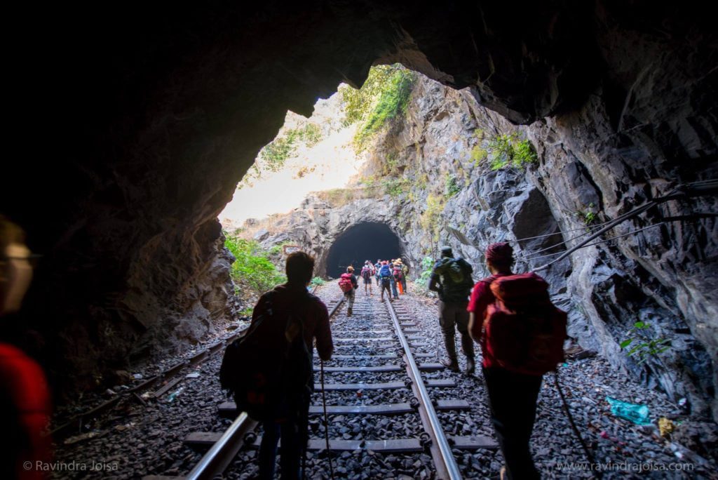
We spent the night near to the Dudhsagar waterfall, through many railway tunnels, more than ten to twelve streams, entered Karnataka's jungle, crossed Castlerock, and arrived at an ancient historic temple at Tambdi Surla. We bathed in practically every creek we crossed.
Goa Trek cost and what is included
The entire cost of this 10-day Goa trek including Youth hostel camps from Panjim to Panjim base camp was Rs. 3,990 (it has since escalated). Food, transport, train costs, forest admission in Goa and Karnataka, waterfall access, permits, guide charges, tent stay, insurance, cultural program at base camp, and a snake session are all included in the price.
Not all of them are granted permission to enter the forest. Forest Department rangers conducted numerous checks. This journey was completed in December-January 2015-16.
Goa Hike in Detail
Arrival at Panjim
The campground is in a fantastic location, near to the Mandovi River, and offers a strong connection. The market, which is located between the campsite and the Panjim bus terminal, is an excellent spot to visit near to the campsite. You may take the bus or go for a long stroll along the Mandovi River.
Visit in the evening to take in the sunset and a low tide walk along the shoreline. Miramar beach, which is a short walk from the campground, is a great place to spend extra time till it becomes dark. You might also go to the senior citizen park adjacent to our campground and watch the sailboats in the evening. Read more - Day 1 – Arrival at Panjim.
Miramar Beach to Dona Paula
The campground is in a fantastic location, near to the Mandovi River, and offers a strong connection. Just outside the campground is a shop where you may get any last-minute supplies. Visit in the evening to take in the sunset and a low tide walk along the shoreline.
Miramar beach, which is a short hike from the campground, is a great place to spend extra time till it becomes dark. You might also go to the senior citizen park adjacent to our campground and watch the sailboats in the evening. Hike from the campground to Raj Bhavan through Miramar beach to acclimate. Then it was on to Dona Paula and then back to the campground. Read more - Day 2 – Miramar Beach to Dona Paula
Benaulim Beach to Campal Sports Complex
The third day of the Goa trek is a long flat 11-kilometer walk from Benaulim beach to Cansaulim beach. In between, we visited some well-known south Goa beaches. This location is great for spending time with friends while on vacation.
South Goa beach is a beautiful location with a clean beach that is less congested, making it perfect for New Year's Eve celebrations. A beautiful location for water sports such as speed boats, parasailing, and other water sports. Read More - Day 3 - Benaulim Beach to Campal Sports Complex
Cansaulim to Dudhsagar Camp
The fourth day of our Goa trek from Cansaulim to Dudhsagar camp was a lot of fun. After spending the entire day on day 3 in Benaulim, Cansaulim beach, and so on, day 4 was very different as the entire track was in the forest. The first 45 kilometers were via railway, followed by a muddy jeep route and seven stream crossings in the forest.
On this day, we don't get to view the Dudhsagar waterfall, but we do arrive at the campground, which is quite near to the Dudhsagar waterfalls. The entire ten-kilometer route runs beside a railway track. Read more - Day 4 – Cansaulim to Dudhsagar Camp
Dudhsagar waterfall camp to Kuveshi
Day five of the Goa Trek was, in my opinion, the most anticipated of all. We had covered more than 12 kilometers of the trek, including the very famous Dudhsagar waterfall, tunnels, crossing the bridge that goes right across the waterfalls, then the steep climb to the tip of the waterfall and taking a bath there, followed by a long walk all the way to Kuveshi, which is in Karnataka. On day five, we begin our walk in Goa at the Dudhsagar campground and finish in Karnataka at Kuveshi. Read more - Day 5 – Dudhsagar camp to Kuveshi
Kuveshi to Anmod via Castlerock
The sixth day of our Goa trek was more of a journey through the forest, passing a few creeks and dry grassland. Despite the fact that this was a Goa trip, we spent the entire day in Karnataka. We traveled from one hamlet to a little town called Castlerock, then back into the woods to another community called Anmod. We had traveled roughly 17 kilometers in total. Read more - Day 6 – Kuveshi to Anmod via Castlerock
Anmod to Tambdi Surla
The seventh day of our Goa trip was a hard climb. Starting from a hamlet in Anmod, Karnataka, and continuing through the lush rain forest to Tambdi Surla, Goa. A location is well-known for its ancient temple and historical significance. The seventh day of our trek was largely in the jungle, which is ideal for folks who conduct bird study. From Anmod to Tambdi Surla campground, the journey takes around half a day and covers about 10 kilometers. Read more - Day 7 – Anmod to Tambdi Surla
Tambdi Surla to Panjim
Tambdi Surla was a wonderful place to stay. We were relieved to have completed seven days of the hike with only one day remaining. We were still in the thick of the rain forest, but we were quite close to the excellent spot since there was road access.
The old temple, a creek next to our campsite, a massage center in the middle of nowhere near our campsite, and a cabin where we all sat together the entire evening conversing non-stop gave us a sense of contentment. It was the last day of our journey, so it was a mixed bag of emotions. Day 8 was spent walking through the jungle, passing by an ancient Shiv mandir (temple) parallel to the stream. Read more - Day 8 - Tambdi Surla to Panjim
Goa Hike - YouTube Video Playlist
Enjoy watching all the YouTube video playlists below and don't forget to subscribe to my YouTube channel and my blog for more updates.
Hotels in Goa
Where to stay in Goa? - Because Goa is a tourist destination, staying there should not be an issue. Even during peak season, especially around the holidays, hotel prices can rise. The cheapest option is to get a dorm room at a hostel, of which there are several, but you must plan ahead of time.
Also, if you are a YHAI participant, you can extend your stay before or after the program by speaking with the local staff or the camp leader. We received assistance from them and stayed at the campsite for one more day, paying only 300 rupees more for meals and celebrating the New Year after finishing the hike. Hotels in Goa will undoubtedly be much more expensive at this time of year.
Domkhar rock art sanctuary is located in Leh's Domkhar hamlet, right on the banks of the Indus River. The location is well-known for prehistoric artwork created by tourists. The major source of income for the people in this region is apricot and apple cultivation. This is a destination for folks who appreciate the historical artwork of our forefathers. There are various rock-carved sculptures that are considered to be between 2000 and 4000 years old.
Where is Domkhar rock art sanctuary located?
Domkhar often spelled Damkhar, is a settlement in the Indian state of Ladakh's Leh district. It is situated in the tehsil of Khalsi. The Domkhar Rock Art Sanctuary was established in 2012 to protect the area's prehistoric petroglyphs. Domkhar contains about 200 dwellings. A visit to this place was a part of our Youth Hostel organized Lamayuru cycling expedition.
Domkhar, a little settlement on the banks of the Indus, is 160 kilometers from Leh. You may drive from Leh to Skurbuchan. Domkhar Rock Art Sanctuary is on the way to Sakar. Its rippling green meadows are studded with the shadows of towering poplars. Large stones line the rushing river, some black and polished, others veined with cracks, and many with prehistoric sculptures of men and monsters on their dazzling surface.
About Domkhar rock art sanctuary
I made my way through the rain to Domkhar Rock Art Sanctuary, where I pushed through the gates beneath the sanctuary's welcome board. I'm attracted to the warmth of a Ladakhi kitchen, where everyone sits cross-legged on the floor. This is the house of Stanzin Thangjuk, the farmer who has been important in conserving these rock engravings on his own.
The admission fee is Rs. 30 and includes butter tea and snacks. We could go to the owner's house because the area is private property. This was an opportunity for us to get to know the people, their way of life, and so on. The carpet and artwork in the hall were brightly colored. We drank the local tea, which was made of tea, yak milk, butter, and salt, with dried fruits and fresh apricots.
The Domkhar rock art refuge and farmland are both located in the owner's backyard. They raise apples and apricots on the fields, which are subsequently dried. This product is then packaged and sold on the local market or exported. There is also the chance to get things at a considerably lower price than what is accessible outside. A kilogram of dry apricot costs around 300 rupees.
What is rock art called?
Rock art is defined by anthropologists and archaeologists as pictures cut, sketched, or painted onto immovable rock surfaces. Petroglyphs are images that have been etched or engraved onto the rock. Pictographs are images created using paint or other pigments. Paintings, sketches, engravings, stencils, bas-relief carvings, and figures made of beeswax in rock shelters and caves are examples of rock art.
We continued on our journey to the Domkhar rock art refuge. The prehistoric engravings on the gleaming black stone were stunning. The Domkhar rock art sanctuary is located right adjacent to the bank of the Indus River, where most ancient travelers rested overnight or for a few days before continuing their journey. The artwork is stunning and in excellent shape. The carvings depict prehistoric hunting scenes, numerous animals, anthropomorphic characters, written language, religious symbols, and other symbols.
There are further rock drawings throughout the 35-kilometer stretch between Domkhar and Khalste hamlet, however many have been ruined by human activities. Many academics, both Indian and international, performed an admirable job of investigating Ladakh's rock art, but this did not aid in the preservation of the petroglyphs. Such petroglyphs can be found all across Ladakh, with notable locations outside of Domkhar being Tangtse, Khaltse, Kharu, and Biama.
It is a must-see if you are in the vicinity of Lamayuru. At Domkhar rock art refuge, you can also purchase native herbal remedies, honey, and dried fruits. To get a sense of the location, watch the video above. Hope you enjoyed reading this blog post. Buy me a coffee to support my work or you can go to my store to buy some of my images. Also, do not forget to join my FriendZone by signing up for my newsletter and SUBSCRIBE to my YouTube channel.
Have you ever captured an image and wondered why it is blurry? This is a typical problem that most of us confront when taking pictures. The major problem is the camera shake, which should have been taken into account throughout the capture. In certain circumstances, we purposefully create blur to deflect the viewer's attention away from the subject.
Why are my photos not sharp?
If the subject in your photograph is fuzzy but anything closer to the camera or farther away is perfectly in focus and clear, the problem is most likely one of focus. If the entire image is hazy and nothing is crisp, it is usually due to using a handheld shutter speed that is too lengthy. Blurred photographs might stem from a lack of understanding of your own camera and how to use it.
How do you stop blurry pictures?
Low light. The camera needs more light and this can be achieved using shutter and aperture.
Keep the aperture wide open f2.8 etc. This allows the camera sensor to capture more light.
Shutter speed. Make sure that the shutter speed is always more than the zoom range. Example: for 55mm the shutter should not be lesser than 1/60th of a second.
For zoom lenses, vary the shutter as per the zoom value.
Try increasing ISO under low light.
Use a tripod, not just some ordinary free tripod that you get along with your camera - Read more on tripods here - link.
Switch on VR (Vibration reduction) or IS (Image stabilization), but don't be fully dependent on it.
Capture in RAW and take manual control instead of automatic.
Once you capture, check the image on the display screen. Zoom into the image and check the edges of an object.
For those using HDR, make sure that you don't move while capturing HRD images. You will capture 2 to 3 different images at different time intervals in a very small interval of time. It then stitches these images together.
Low light photography and use of wide-angle with f2.8 aperture. Image captured at Dal Lake, Kashmir, India.
How do you make your camera blurry on purpose?
To get blurry photographs, take many shots with a fast shutter speed. Adjust the shutter speed on your camera to roughly 1/30th of a second. Follow a moving item with your camera until it passes the center of your lens.
How to Take Blurry Pictures?
Blurriness is typically used to indicate movement in photographs, but it may also be used artistically to improve your photos. A simple and frequent approach to shooting with blurring effects in the backdrop is to employ the bokeh lighting technique, which makes the subject of a shot seem concentrated while the background is blurred. With bokeh lighting and other approaches, you'll be able to produce fuzzy photos by changing the camera settings on your phone, utilizing different modes on a DSLR camera, and adjusting the light source in your shot.
Creating Blurs with a Mobile Phone - Use portrait mode on your mobile device. This function is now accessible in the majority of mirrorless or DSLR cameras too. You may use editing applications on your iPhone or Android device to take and edit images. Also, while taking the photo, zoom close on the main subject to blur the surrounding.
Using a DSLR or Mirrorless Camera to Take Blurry Photos - Set your camera to shutter priority mode to lower the shutter speed and use a wider lens to create a hazy backdrop. Take many images with a quick shutter speed to obtain blurred photos, then use a macro lens to acquire zoomed-in shots.
Changing the Light Source. Find a decent light source for your photograph and position the subject to enhance the blur effect. You can experiment with reflectors and other light modifiers to achieve the desired effect.
How do you make foreground blurry and the background in focus?
Moving closer to and focusing firmly on your subject, as well as ensuring the backdrop is far away from your subject, makes it simpler to produce a blurred background. Short focal lengths have a broad field of view, which keeps features in the front and background in focus. To know more read the article - Understanding lens focal length.
Camera Panning, in the panning technique the focus should be on the subject.
There are other reasons, in case the subject moves, in which case you will have to use the camera panning technique. You need to master this to get those right shots with controlled blur along with the focus on the subject. The only solution would be to practice.
Why is my Camera not focusing?
'Camera lens won't focus' is a common question and is one of my most viewed videos on my YouTube channel. I see that people have trouble focusing on the subject with some common focus issues that I have listed and how you can fix that without taking your camera to the service center to fix the issue.
https://youtu.be/MuE9EVfzYMc
https://youtu.be/Q0bhL5KQQx0
Hope you enjoyed reading this blog post and start practicing to capture photos and edit like a Professional Photographer. Buy me a coffee to support my work or you can go to my store to buy some of my images. Also, do not forget to join my FriendZone by signing up for my newsletter. Consider subscribing to my YouTube channel.