Chatru - A beautiful Campsite in Lahaul valley | Hampta Pass Trek | Day 5

Day 5 of the Hampta Pass trek is from Shea Goru to Chhatru or Chatru campsite crossing the Chenab river. Trek to Chatru Himachal Pradesh from SheaGoru is a moderate 2-2.5 hours of walking on moraine and lose rocks on gentle inclines. This is followed by a descent to Chatru across a couple of glacial flows. As you move closer to the road, the descent gets a steep and little tricky. The last stretch is right next to the Chenab river and the trek ends next to the bridge.

Checkout previous day: Shea Goru via Hampta Pass | Hampta Pass Trek | Day 4

Shea Goru Campsite, at the time of sunset

Shea Goru Campsite

Even though Shea Goru campsite is just below the Hampta pass and in a valley, the evenings next to the stream can be beautiful. Golden hours can light up the snow cap mountains gold. The view of Mount Indrasan can be majestic from slightly above Shea Goru campsite. You can even spend the mornings and evenings with your legs dipped in the ice-cold stream. This is one of the most beautiful campsites of this entire trek. Also, you should feel great here as you have already crossed the Hampta Pass and is now at a viewable distance.

Crossing the ice cold stream

Our hike downhill on the next day starts with the crossing of an ice-cold stream, right next to the campsite. It is hard to cross the stream barefoot as there are sharp rocks underneath from the glacier above. From here it is a gradual descent, continuing to the valley below. By the way, we are now in the Lahaul and Spiti region of Himachal.

Lahaul Spiti Valley after Hampta Pass towards Chatru Campsite

The hike downhill towards Chatru

You will need to traverse the edges of rocks. Sometimes it might just be easier to get down into the river/glacier bed below to skip the rocky section and get back up. There are also a couple of places with slippery loose soil. Also, you get to see too many hiking trails here in the region. These are formed by the livestock raised by the locals. This section would take three hours when you are out of the mountains. You are still at a height but you have the road right across. The Chenab river separates you from the road. You can even see the vehicles appearing like a toy from here.

Himachal Public Bus from Kaza to Manali via Chatru campsite and the Chenab river below

Glacier View above Chatru

There are multiple huge glacial flows coming down from the mountains on the side of the Chenab river. Also, the view from this place of the glacier in front is breathtaking. Zoom in your camera to see the glacier in detail as shown in the image below. There isn't much human activity in this region other than a few shops which remain closed half the year. Moreover, the highway connecting Manali with Kaza has to be constructed every year because of the extreme weather.

The Glacier view as we hike downhill towards Chatru campsite

Where is Chatru located

Chatru is a green respite in the middle of the vast expanse of Himalayan snow. It is a little community of about 1000 people that serves as a stopover for several major hiking routes. The natural splendor of Chatru is beyond description. You may even start with the Hampta Pass trek from Chatru, cross the Hampta Pass on the second day, and then descend all the way to Manali valley by following the Rani Nala (stream) till you reach Jobra.

https://youtu.be/o3nNAmVfWZ4

Weather at Chatru campsite

Winter in this region is inhabitable and the roads remain closed. During the monsoon and summer, the Chenab river water level and the water current can be menacing. Continue to hike till you reach the bridge. You will find a few shops and dabhas here where you can have some hot tea and parathas. This is the Chatru village. You may camp here or go further to find some flat land to camp.

Where to stay in Chatru

The area is densely packed with Dabha and repair businesses. These stores even offer campgrounds within the Dabha where bikers and truck truckers may stay at a low price. If you continue on the road to Chandratal, you will come across some magnificent campsites where you may camp on your own next to some dabha or there are some decent pricey luxury campgrounds designed for visitors. These are temporary camps that will only exist over the summer.

Places to go in Lahaul Valley

Lahaul valley has some of the best landscapes and you will definitely love this place if you are a landscape photographer. If time permits then consider visiting the Chandratal (lake) and Kunzum Pass with incredible and stupendous views. You can plan to go to Leh from here. From Atal Tunnel instead of taking the tunnel road to Manali, continue further to Kelong and then to Leh.

https://youtu.be/h1rUVWy_JKc

To conclude, the last day of the hike can be much more relaxing as it is all downhill but can be exhausting as well as it is a long walk downhill. This is where you need to have a good pair of shoes else you can easily get blisters. Check out the video below and consider SUBSCRIBING to my YouTube channel.

Shea Goru via Hampta Pass with a stunning view of Mt Indrasan | Day 4

Trek to Shea Goru via Hampta Pass is a few hours of gradual ascent. The trail after becomes a steep downhill after the pass. You get to see some amazing landscapes when you are at the pass from the most beautiful valleys, to the mountain peaks and glaciers. This day of the trek is the most challenging. It can be tricky at some places and is dangerous as well.

Check previous day: Balu Ka Ghera – Hampta Pass Trek – Day 3

To the right bottom is the Shea Goru Campsite, to the center, is the Hampta Pass. Photo: Ravindra Joisa

The ascent to Hampta Pass

Day 4 of the Hampta Pass trek in the Himalayas, is an ideal trek for beginners who are completely new to high altitude Himalayan treks. The trail isn't super easy but not too complex either. But with zero practice, this slope can prove challenging. The trail from Shea Goru via Hampta Pass can be broken into two stages. The climb to Hampta Pass is moderately steep with few flat walks on snow patches, followed by a steep descent to Shea Goru. You will want to take a small break at the top of the pass, have lunch there and then start the descent.

On the way near Hampta Pass to the right. Photo: Ravindra Joisa

The Rock Fall area

You begin your day by heading towards the mountains from Balu Ka Ghera which is the day 3 campsite of Hampta Pass trek, check out the link above. You may get to see lots of tiny pink and yellow flowers growing by the side of the river. Move along the river for an hour after which you will be above it. In a rock fall-prone area to the left, the climb picks up. Be careful at the top of the pass as this is a rockfall area. Also, on the way to Shea Goru via Hampta Pass you might see some interesting patterns in the stones of the prehistoric lava flow.

The final ascent near Hampta Pass, crossing the snow patch full of rock and boulders.
The final ascent near Hampta Pass, crossing the snow patch full of rock and boulders. Photo: Ravindra Joisa

The Danger Zone and the Pass

Keep climbing up and you reach the Hampta Pass which is at 14,000 feet. Do not underestimate the altitude of Hampta Pass as there were incidents of death recently. High altitude sickness, rockfall at the pass, and narrow trail while descending can be notoriously dangerous at Hampta Pass. Two hours of a steep descent from the pass, followed by sliding on a snow patch and finally easing off into a flat walk till Shea Goru campsite.

When you are at the pass, you get to see some of the amazing valleys. Behind is the journey that you covered all these days from Jobra campsite, full of greenery. Moreover, to the left is the dry valley of Lahul Spiti. To the right is the Indrasan peak which stands tall at 6221 meters.

After crossing Hampta Pass, Peak at the center is Mount Indrasan. Photo: Ravindra Joisa

First glimpse of Shea Goru campsite

Just after crossing the pass, the view of Shea Goru, Lahul Valley, and mount Indrasan is breathtaking. The descent is slightly trickier than the ascent. You can see the Lahaul valley side of the pass below and to the left. Once you reach down the valley take a left. To the right is the Indrasan peak. By the way, you are now in the Lahul valley and expect dry weather. Because we are still in the mountains, Shea Goru's weather cannot be predicted.

The glacier near Shea Goru

This area near Shea Goru towards Mount Indrasan appears to be a glacier once. You get to see from above the valley just after crossing Hampta Pass. The glacier is hard to make out as it is covered with stones and huge boulders. But if you zoom your camera lens, then you can see huge crevices in glaciers. This is when you will realize that it is not the rock, but a glacier covered with dust.

On the other side of the river, Shea Goru campsite. Photo: Ravindra Joisa

Finally, we made it to Shea Goru. Shea Goru is an almost level walk from here next to the stream formed by the melting of glaciers ice. It should be an easy walk some may find it tiring after the long day traversing the pass.

Also read: Absolute mandatory Hiking Accessories to carry

Is Hampta pass a difficult trek?

The Hampta Pass trek is simple to moderate in difficulty. Including the difficulty of the Chandratal Lake hike. Making this hike, which is ideal for beginners. The Hampta pass hike lasts 5 days and 4 nights. Is Hampta worth a pass? - Hamta Pass is a beautiful pass in Himachal Pradesh. It is a worth visiting site in the Himalayas of India if you want to be away from the city crowd and experience true bliss. Shea Goru is one of the campsites in the Hampta pass hiking trail. We have Shea Goru on one side and Balu Ka Ghera on the other side. You cannot camp at the Hampta pass.

Firstly, choose a nice campsite close to the river and retire happily for the day after crossing the Hampta Pass. Secondly, spend less time inside the tent, and explore the campsite. Also, a climb to the nearby cliff to get a better view of the Indrasan peak. If you are a photographer like me, then you may want to go late in the evening or early morning for a better golden hour view of the peak.

Checkout next day: Chatru Campsite | Hampta Pass Trek | Lahaul | Day 5

Watch the video below and SUBSCRIBE to my YouTube channel. Also, consider subscribing to my newsletter for travel and photography tips and stories.

https://www.youtube.com/watch?v=P-HfEx4rZEU

Unique Monkey Temple in Jaipur | Interesting artwork at Galtaji

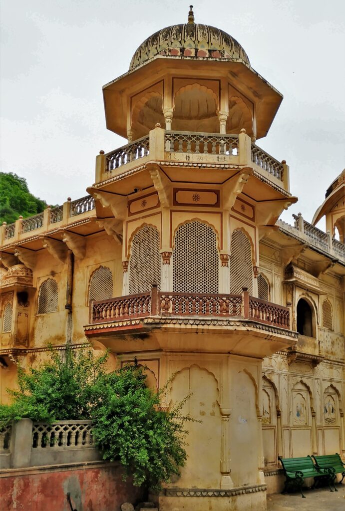
Galtaji or Galta Ji or Galta, Monkey Temple in Jaipur is an ancient Hindu pilgrimage. It is about 10 km away from Jaipur city center. The site consists of a series of temples built into a narrow crevice. Further, a natural spring emerges high on the hill and flows downward, filling a series of sacred kunds (water tanks) in which pilgrims bathe. There are visitors and pilgrims who can ascend the crevasse.

My journey starts from my hometown at Mangalore to the Pink City Jaipur in Rajasthan, India a city in the northwest of India. We took a flight and then hired a rented self-drive car. On arrival and check-in at a hotel, visit some of the smaller known places. This is day 1 of the Pink City Jaipur in Rajasthan tour. And our first stop is Galtaji Jaipur Monkey Temple.

Galtaji Jaipur Monkey Temple. Photo: Ravindra Joisa

Why is Galtaji famous?

Galta was the earliest Vaishnava Ramanuja Peeth in northern India and grew to become one of the Ramanuja sect's most prominent centers. A variety of pavilions with rounded roofs, carved pillars, and painted walls can be found at the temple. The complex is built around a natural spring and waterfalls, which form seven Holy Ponds.

In addition, continuing past the highest water pool to a hilltop Sun temple. The temple complex of Sita Ram is known as the Galta monkey temple Jaipur temple due to the large number of monkeys living around this temple.

Which temple is known as the Monkey temple?

Where is the monkey temple in India? - When e speak about the Monkey temple Jaipur, there are many in India, Nepal, and other Asian countries. Galta Ji is a huge Hindu temple complex located 10 kilometers east of Jaipur. These temples are a major tourist attraction since they are home to a huge population of monkeys, which gave origin to the complex's common moniker, the monkey temple. Who built Galta Galtaji Temple? - Diwan Rao Kriparam, an attendant in the court of Maharaja Sawai Jai Singh II, erected the Galta Ji Temple. The temple complex dates from the 18th century.

galta monkey temple jaipur
Galta Monkey temple Jaipur. Photo: Ravindra Joisa

Reality of Jaipur Monkey Temple

Charges were minimal, but the maintenance needs urgent improvement. Moreover, the entrance of the temple complex has numerous ancient paintings. Also, during our visit, all of a sudden few hundreds of monkeys were on the move towards the water tank. It certainly looked like a movie scene from the Planet of the Apes. These monkeys, along with the humans (the real monkeys) make this place dirty and require continuous maintenance and not one time. Also, the algae growth in the pond has turned the pool water green.

Other places to visit around include the Hawa Mahal Jaipur – Stupendous and unique architectural design, Jaipur Amer Fort – An Extraordinary Hilltop architectural marvel, and many more. On the way to the Galtaji temple, you may visit Sisodia Rani ka Bagh.

Sisodia Rani ka Bagh

After that, on the way back to the city a visit to the Sisodia Rani ka Bagh is a must. It was built in the 17th century. Firstly, the place had some beautiful wall paintings of typical authentic Rajasthani style. Secondly, a double-storeyed palace occupies the top terrace of the garden. In addition, the palace has many galleries, pavilions, and beautiful murals depicting scenes from the life of Lord Krishna. The paintings are visible even on the outside at the entrance. This place remains the same as how it used to be in the earlier days except for the tar road.

Sisodia Rani ka Bagh
Sisodia Rani ka Bagh. Photo: Ravindra Joisa

Akshardham Temple Jaipur

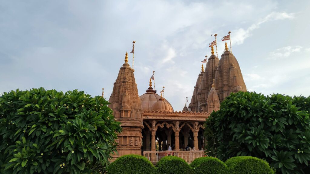
Next, we go to the other side of Jaipur to visit Akshardham Temple Jaipur. One of the well-known tourist attractions of Jaipur. The temple is known for its beautiful architecture, magnificent idols, sculptures, and carvings. Also, it is dedicated to the Hindu God, Narayana. Above all, the Akshardham temple provides a real glimpse of Indian architecture, cultural heritage, and sculptures of Hindu gods to visitors. We spent the evening enjoying tea and snacks at the temple complex. The lighting at night is beautiful. Therefore, wait for the turn-on of lights.

Akshardham Temple Jaipur
Akshardham Temple Jaipur. Photo: Ravindra Joisa

Jaipur Birla Mandir

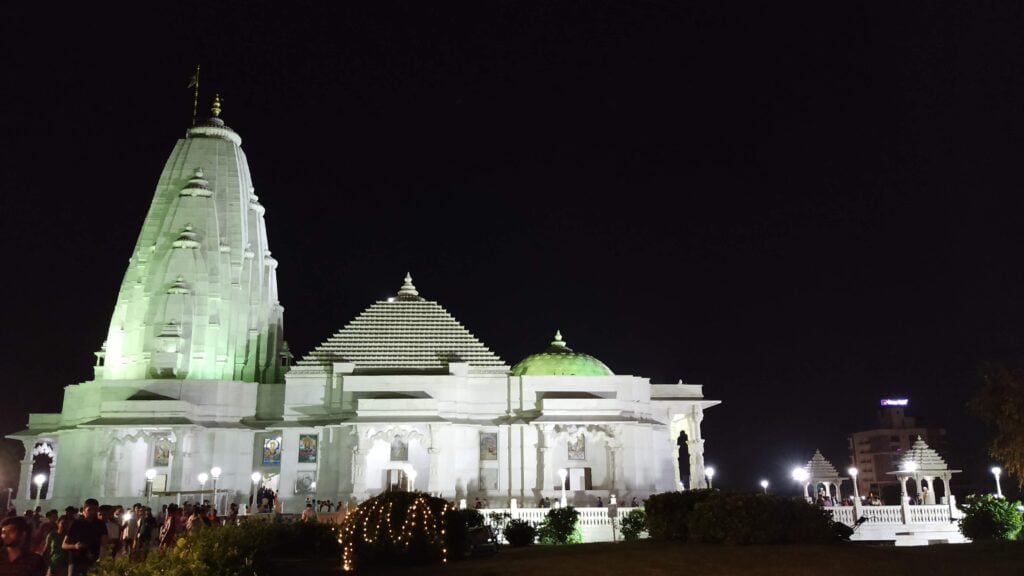
It was dark and we decided to cover one last place for today. And, that was the temple building, all using white marble, the Birla Mandir Jaipur. There are four distinct parts of the mandir/ temple: its sanctum, tower, main hall, and entrance. It has three towers, referencing the three main faiths of India. As well as stained glass windows depicting traditional Hindu stories. Again, expect the crowd at the temple complex. The lighting around the temple is beautiful at night.

Jaipur Birla Mandir at Night
Jaipur Birla Mandir at Night. Photo: Ravindra Joisa

To conclude, in half a day you can cover the famous Galtaji Jaipur monkey temple, Sisodia Rani ka Bagh, Akshardham, and Birla Mandir. Consider joining my Friend Zone for more stories. Stay tuned as I will be covering more places in the coming days. Also, check the below video and consider SUBSCRIBING to my YouTube channel and click on the notification bell for more travel stories.

https://youtu.be/LwPhO7gBmvA

Hotels at Jaipur

There are multiple hotels in Jaipur from budget hotels and hostels starting with a price tag of 600 rupees to the expensive ones that will cost you around 9000 rupees which is in close proximity to the Amber fort. There are hotels in this area with a view of the fort. Car rentals and bike rentals are available for a reasonable price and you may want to check at the hotel desk or they can take you around in Jaipur.

Balu Ka Ghera | Scenic campsite before an intriguing pass crossing

Trek to Balu ka Ghera campsite is moderate and is another beautiful campsite. It is a short meadow walk followed by a boulder section for a couple of hours, leading to a trail on loose rocks all the way to the campsite. By the way, Jwara is one of the most beautiful campsites in the Himalayas.

Jwara campsite
Jwara Campsite - Hampta Pass Trek. Photo: Ravindra Joisa

Also read - previous day: Trek to Jwara – Hampta Pass Trek – Day 2

Hiking next to Rani Nalla

Firstly, a very gradual incline through the day right next to the stream. Secondly, During the monsoon, because of the rain, you get to see a lot of unnamed waterfalls. Just for fun, you are free to keep your own name to one of these waterfalls. On this day you will gain approx 1,500 feet and will hike right next to the Rani river. The melting of snow forms the stream and hence the river Rani, which flows down all the way to the Hampta Valley. In front are snow-clad mountains beyond which lies the Hampta Pass.

Rani River on the way to Balu Ka Ghera campsite
Rani River on the way to the campsite

A visit to Dabha

Visit the Dabha if it is open and have warm tea. Surprisingly, it is not overpriced considering the location of dabha. The Dabha owner can play mouth-organ. Request him as he is happy to play it for you and do not forget to appreciate it. On request, he kept us entertained with some melodious music, while we had snacks, hot spicy maggie, and much-needed warm masala tea on a rainy day. Make sure to go around the dabha and try to pick any leftover plastic items and keep the Himalayan slopes clean. We follow this in all the slopes.

Ravindra Joisa in front of Dabha - Hampta Pass trek

Valley before reaching the campsite

Walk along the Rani river heading into the valley. On your way to the campsite, you will find a variety of tiny flowers – purple, yellow, pink, etc. There are high chances of you finding some wild strawberries on the way. It takes about half an hour to cross the valley. After you come out of Jwara, you need to walk further along. The terrain flattens as you reach Chota Balu Ka Ghera where you can rest for a bit and have a packed lunch.

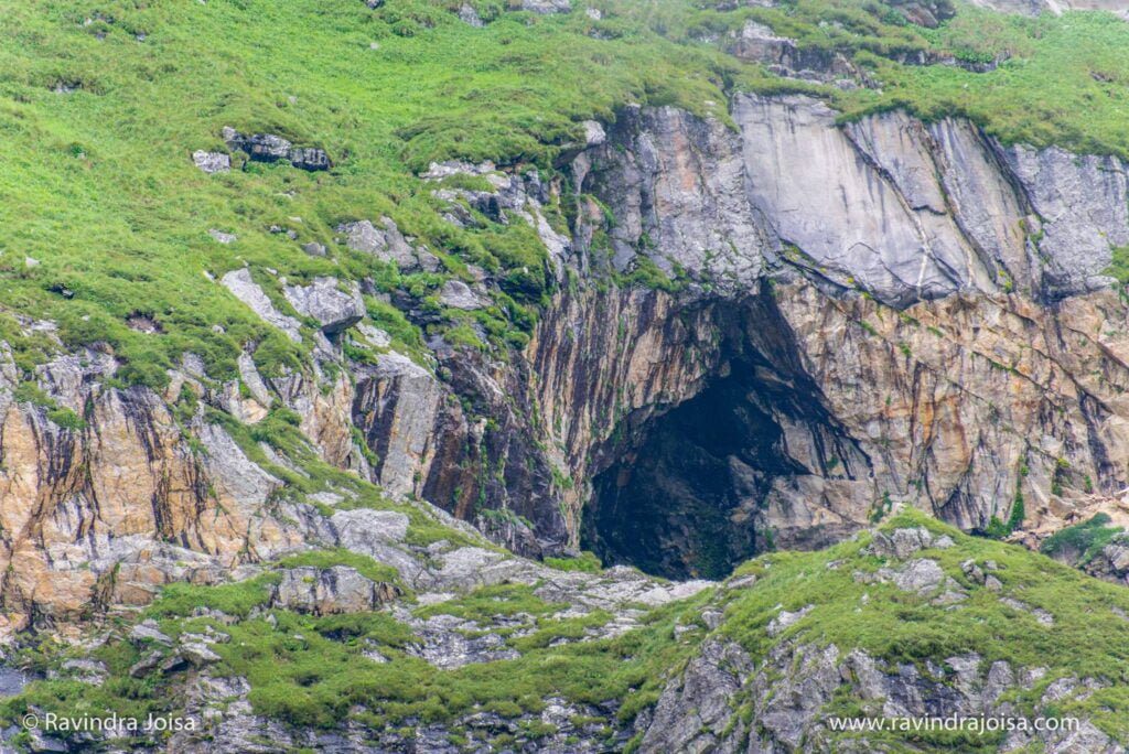
Continue further along the river, crossing small snow flows and jumping across rocks. Towards the end, the rocks are quite far apart, and jumping across the gets tricky. Soon after, you will reach your destination for the day. By the way, to the right of the trail just before the campsite is a huge cave. Explore this place if time permits.

Cave near Balu Ka Ghera Campsite. Photo: Ravindra Joisa
Cave near the Campsite. Photo: Ravindra Joisa

About Campsite

Balu Ka Ghera or the bed of sand is the last campsite before Hampta Pass. In addition, the ground is formed mainly by the sand and dust brought down by the mountain slopes and the streams around the campsite. The water is ice cold and if you can manage to walk in the sand bed then there is a stone at the center of the sand bed where you can sit for a while and enjoy the entire trail that you just covered.

It is level ground and behind you are the mountains you will traverse the next day to cross the famous Hampta Pass. Pitch your tent and enjoy a beautiful sunset behind the Bandarpunch peak. Moreover, you are now close to 12,500 ft (Balu ka Ghera altitude) above sea level.

Balu Ka Ghera or the bed of sand - Hampta Pass trek
Balu Ka Ghera or the bed of sand - Hampta Pass trek. Photo: Ravindra Joisa

In conclusion, this is a wonderful campsite to explore. Spend less time inside the tent and use it only to sleep. Spend all your time outdoor. Check out Trek to this campsite from Jwara, day 3 of Hampta Pass trek on my YouTube channel, and consider SUBSCRIBING.

Read Next: Shea Goru via Hampta Pass | Hampta Pass Trek | Day 4

https://youtu.be/NYLOC_p3Ea8

River Place Nature Trail - Appealing and Awe-inspiring hike in Austin Texas

The river place nature trail is a picturesque, riverfront park offering a popular forested hiking trail, small waterfalls & wildlife views. If you are wondering where to go hiking in Austin then river place nature, also known by the name Canyon trail is an ideal weekend getaway. This place is about 20 minutes drive from Austin downtown or from Roundrock. River place nature is almost 3 miles long, one way, and has connectivity by road at both ends. On one end it starts with a mini lake with fountains in between.

Boardwalk at river place nature trail - River Place Nature Trail by Ravindra Joisa
Boardwalk at River place nature trail; Image: Ravindra Joisa

Hiking Trail entrance

The river place nature trail begins with a boardwalk surrounding the lake followed by hiking next to a stream. If you are not keen to go on a hike for 2 hours, you might want to consider sitting on the bench on the boardwalk. This is a peaceful place when there is less crowd. Also, there is a fountain in the middle of the lake and forest around.

Golf course next to river place nature trail
The golf course as seen from the river place nature trail

About the River Place Nature Trail

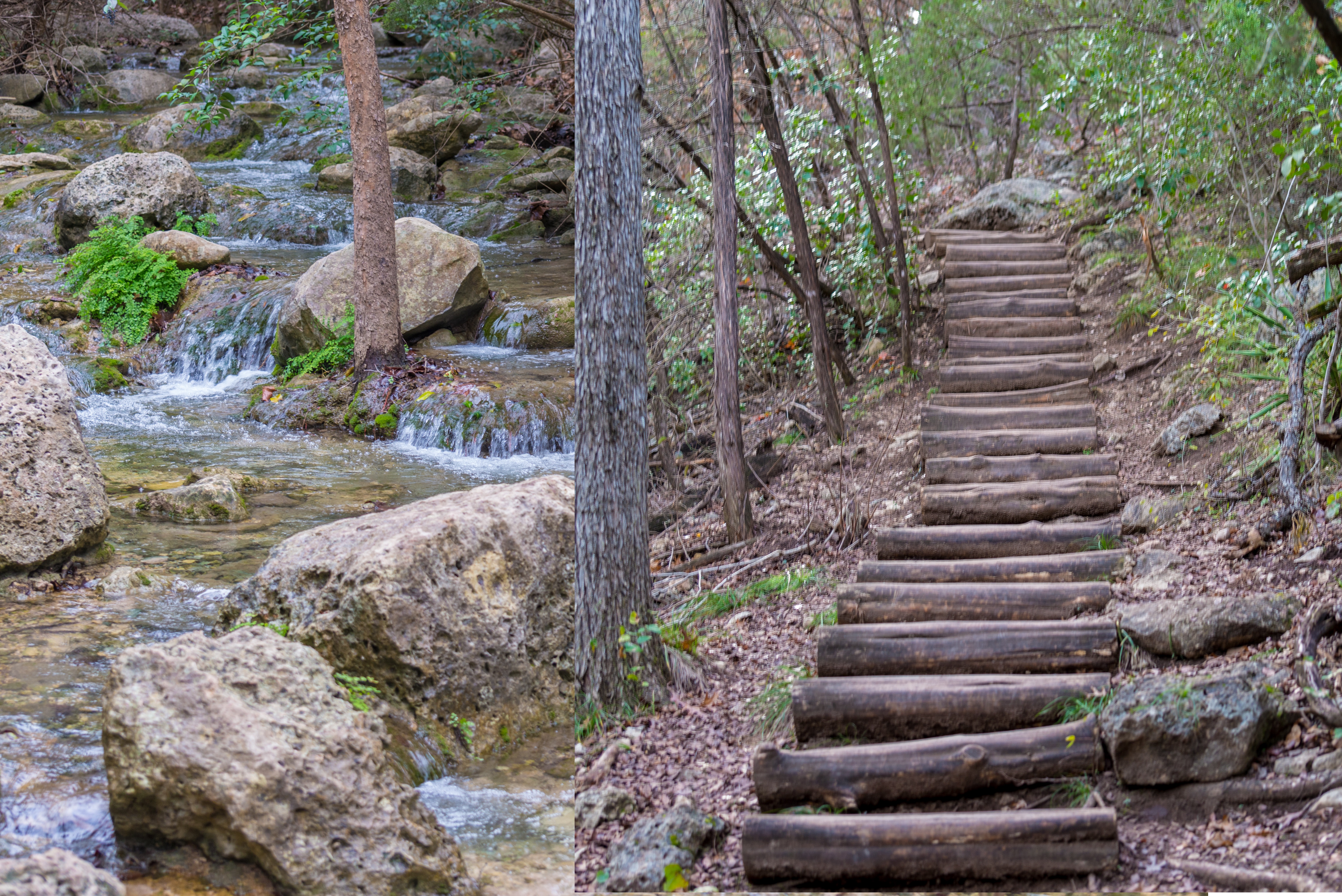
The trail is a continuous ascent and descent, next to a private golf course. You get to see the hilltop villas as you hike along the river place nature trail. Even though the trail doesn't feel like a trail in the rain forest, there is an abundant supply of water. All along the trail, you get to see a stream next to the trail. As you walk along there are wooden logs, to cross with a few markings along the trail showing the direction. Note that this Canyon trail has nothing to do with the grand canyon or the antelope.

Wild flowers and leaves - river place nature trail Austin Texas
Wild berries and leaves

What hiking trails are open in Austin

I visited this place in mid-December. As a result, the area appeared dry. You may spot some bright-colored leaves and wild berries on the way. The trail appears to be well maintained at some of the places. There was no entry fee back then when I visited. But at present, there is a $ 10 entry fee if you go on a hike on weekends. This is a perfect place if you want to go on a hike with your pet dog. The entry to this trail can also be done from the exit point. Both the ends are well connected by a motorable road. If you are in Texas there are many more hiking trails in Texas, US.

Water Stream and Hiking Trail in river place nature trail
Water Stream and Hiking Trail

Who can hike the River Place Nature Trail

To sum up, the hike is ideal for those who had never been out of the city and want to enjoy nature. Meanwhile, while hiking I saw a few senior citizens who had come with their backpacks. They were practicing for a hike in Patagonia. Meanwhile, the hiking trail and mountains in Patagonia appear similar to those in the Himalayas in India. In short, I would say that this trail is good for beginners who have never experienced hiking. And for those who would love to go for a long walk daily with some ascent and descents. Also, an ideal practice trail for those who love to go for some moderate-level treks.

You might also like: The Alpine Lakes Trek in the Himalayas

Ravindra at Canyon Trail - River Place Nature Trail

As I had come to Roundrock on a business trip just before Christmas, I went on a hike to this place and on the same day went all the way to San Antonio. Don't forget to visit the famous riverwalk in San Antonio, during Christmas. This place appears well illuminated at the time of Christmas, late in the evening. Check out this video and consider subscribing to my YouTube channel.

https://youtu.be/CEAezPlyzK0

Parashar Lake - the unexpected travel story

Why Parashar lake is famous?

One of the most sacred places in all of Himachal is the Parashar lake or Prashar Pond. Parashar Lake is located at a height of approx 9,000 feet above sea level. Surrounded by snow-capped peaks and looking down on the fast-flowing river Beas, the lake is known for deep blue waters and is held sacred to the sage Prashar.

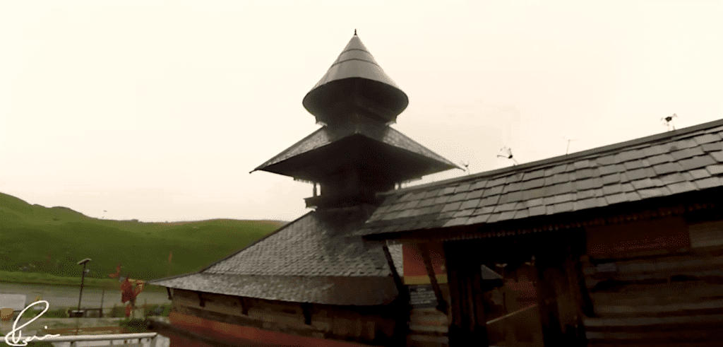
Not only does this mountain boast an abundance of natural beauty, but the secluded hilltop temple is a charming escape from the busy city. And also a great place to experience an overnight temple stay.

Parashar Lake, heavy rain and fog in monsoon showing Parashar lake weather.
Heavy rain and poor visibility at Parashar Lake

Prashar Lake story

It is said that Sage Prashar pondered on the shores of this lake, which is why it is known as Prashar Lake. According to the legend, the lake was formed by Bhima, one of the Pandava brothers. As a result, Bheem (the strongest of the lot) smashed his elbow into one of the mountains, causing a large depression in the earth. Prashar Lake grew from this dent.

Is Prashar Lake Trek easy?

The Prashar Lake trip is 8 kilometers long and takes around 4 hours to complete. The path to Prashar Lake is surrounded by magnificent foliage, waterfalls, and little streams. Prashar Lake trek is a perfect family trek in Himachal and is ideal for beginners. Prashar Lake is accessible by road and you can take your car or bike all the way to Parashar lake.

Here’s the plan - How do I get to Prashar Lake?

We will rent a bike and ride along the river Beas. A right turn at Bajaura is where the narrow and less crowded, a road full of dangerous hairpin curves starts. The road will take you through some extreme landscapes, stream crossing, and some thick forest areas till you reach Prasar. On the next day, we explore the temple complex and return back to Manali.

The 2-wheeler uphill ride to Parashar Lake

Starting from Manali's pleasant stay with a splendid view from our hotel room, we’ll ride a motorbike all the way to Pasar lake. Along the way, we visited the Dechen Choekhor Buddhist Monastry monastery.

https://youtu.be/DuscLPcrzIY

As we had planned this trip during the monsoon, we were not sure of the view and the Prasar lake weather condition. The weather here cannot be predicted with apps as this is a mountainous region. We drove next to the Beas river till we reached Bajaura.

On reaching Kullu, we packed our bags with fruits and energy bars and enough fuel as there is no petrol station on the way. The ride was longer than we expected. The road is full of hairpin curves, narrow dangerous roads, breathtaking views. We stopped multiple times to enjoy the beauty around us.

Parashar lake hotel - The unexpected trouble

We reached late and it was dark and the weather changed drastically. To my surprise, the Himachal Tourism hotel stay that I had booked over the phone was given to someone else. And if you are looking for a Parashar lake hotel, other than the government guest house, you will not find any. But there are a few rooms available in the temple complex but poorly maintained.

There was no signal to call up anyone and luckily the temple staff helped in getting the permission to stay at the temple complex. Thanks to the temple staff who made sure we were comfortable and told us to stay till the weather is clear.

The rooms at the temple are strictly for pilgrims and we just had to pay for the pillow and bed which was available for rent. We had some snacks and a cup of hot tea in this cold weather at a shop in this temple complex at Parashar Lake. To end the first day we got a taste of the monastic life by staying overnight at the Prasar temple complex. It was a pleasant stay with minimal amenities.

The next morning, we were notified not to leave, by the temple staff as there were landslides on the way back, and crossing the stream was next to impossible. But, I had a different plan as we had booked 7 days Hampta Pass trek the next day. Check out my blog post starting from Trek to Jobra Campsite – Hampta Pass – Day 1.

Parashar Lake

After experiencing some morning temple rituals, we explored the place by walking around the temple. Our plan was to hike to the hill nearby and enjoy the view but bad weather and poor visibility made us stay indoors.

There is a floating landmass inside the lake, which is a common natural phenomenon all around the world. The floating land moves in all directions in the lake and covers 7% of the area of the lake. Prashar lake depth - It is said to be unclear how deep the lake is. The temple was built in the thirteenth century and legend has it was built by a baby from a single tree.

https://youtu.be/9hQfPe8aul8

Once it stopped raining, we went around the historic temple complex, got a closer look at the lake surroundings, and said goodbye to the temple staff. The visibility was poor even during noontime. We had our lunch on the way back at a local shop with whatever was available. The view was breathtaking. Parashar lake trek is a common weekend hike for locals in Himachal. And Parashar lake winter trek is famous for the snow-covered lake and mountains around.

Crossing the stream

We had multiple things to worry about on the way back. The 2 wheeler fuel meter was at the red or empty end, did not have information on where the landslides were, and also if we can cross the stream or not. We arrived at the stream, and it looked like the water level had come down. It was still an overcast day but had stopped raining. Crossing the stream all alone would have been difficult, with all my camera gear. Thanks to the locals who helped us in crossing the stream.

More troubles

We continued further with an eye on low fuel. We deliberately kept the engine off while riding or in neutral all the time as the ride was mostly downhill. There was one more blocker that we had. There was a huge traffic jam because of landslides and the bulldozers were at work blasting the stones. It took a few hours but as we had a motorbike. It was easy to cross in the narrow path while the work was still in progress.

Lessons learnt from Parashar Lake trip

There are a few things to learn if you are planning to go to this place. Get confirmation on your hotel or tent booking. Get a higher-powered bullet motorbike instead of a scooty, in our case, it was not available. And have an extra can of fuel. Also, it is better to avoid a trip to this place during monsoon and winter. The place can be too cold at night.

We finally managed to reach Kullu town where we refueled the motorbike and went further to Manali. Finishing the short pilgrimage ride at Manali with all the unexpected adventures, our trip comes to an end. From here on the next day, we opted to go for a weeklong hike to Hampta Pass.

Hampta Pass trek
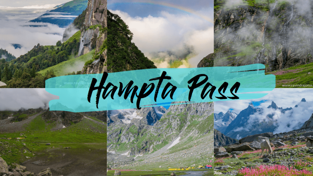
Hampta Pass trek. Photos by Ravindra Joisa

I hope you enjoyed reading this article. Join my Friendzone for some exclusive content.
For more travel videos head over to my YouTube channel and consider subscribing.
So, what is your travel experience? Leave a comment below.

Mount Kanamo, Life-changing Exhilarating Hike

Kibber village is a beautiful small village with a few uniquely built Tibetian-style buildings. The place is known for Snow leopards, Himalayan Yak, Himalayan Ibex, and many more. The place is known for some of the deepest canyons (on the way to Chicham village). Also, Mount Kanamo is almost 70 percent the height of Mt Everest. The villagers are mainly into agriculture and livestock.

In this region, you'll also come across a number of homestays. Kaza is the closest town. You may stay in hostels or hotels in Kaza and visit additional attractions such as the high-altitude post office and Key Monastery. You might want to consider staying in one of Kibber's homestays.

Hiker @ravindra at Kibber - ready to trek Mount Kanamo
Ravindra at Kibber village, Spiti Valley, Himachal, India

Hiking to the Mount Kanamo basecamp

The Mount Kanamo trekking plan comprises staying at Kibber guesthouse for a day to acclimatize, hiking to Kanamo basecamp for a day, remaining at this campground for another day due to the high altitude, and beginning the summit ascent to the Kanamo peak early in the morning. If everything goes well and you don't get altitude sickness, you can return to Kibber the same day because it's all downhill.

You pass through vast fields of green peas and wheat shortly after leaving Kibber. The course begins with a hard incline and gradually levels out over the next three hours. The first view of Mount Kanamo, which stands at approximately 19,600 feet above sea level, can be seen here.

There is a flat stroll followed by a steady incline. You pass by a pond along the route, where we ate our packed lunch. The last two hours of the journey are the most exhausting, but they are also the most beautiful, with some breathtaking scenery. The first signs of altitude sickness appear here for hikers.

Glacier as viewed from Mount Kanamo basecamp
View from Mount Kanamo basecamp, the extreme terrain.

About Mount Kanamo Basecamp

Kanamo Basecamp (KBC) is located at a height of approximately 16000 feet. Spend another day or two after arriving at the campground to acclimate to the increased altitude. Later that day, it was raining outside with severe lighting and thunderstorms, so we stayed inside the tent. This is the final location you'll come across a water supply. Even animals in the wild visit this location to drink water. The view of the surrounding area is spectacular. The perspective demonstrates how rough, wild, and severe the environment is. Many other Himalayan hikes are also popular in the area.

Camping at Mount Kanamo basecamp
Mount Kanamo basecamp

Wildlife at Mount Kanamo basecamp

We were fortunate enough to observe a rainbow and a few rare Himalayan wild creatures, which I documented on Instagram. Because the area is part of the Kibber wildlife sanctuary, any type of campfire or hunting is prohibited. Himalayan Yaks and Himalayan Ibex are among the animals. Snow leopards are more likely to be seen if you travel farther away from this location, towards the glacier or the other side of Mount Kanamo. These creatures are afraid of humans, and we must be careful not to disturb them in any manner.

The walk from Kibber to Mount Kanamo basecamp was that long. Because this area is a wildlife protection zone, don't be shocked if trekking is prohibited after you arrive. Consult the locals. It's important to note that this is a summit climb, not an ordinary trek. We attempted to summit Kanamo Peak after spending a day at Kanamo base camp. You may get a sense of the path by watching my YouTube video below. I hope you enjoyed seeing the film, and in the next video, I'll tell you about my effort at Kanamo Peak. Thank you for watching, and please consider subscribing.

https://youtu.be/0s2fmpV-8KY

You might also want to watch my Hampta Pass trek blog posts or Kashmir Great Lakes and many more. For more stories of this kind join my friendzone and you can buy me a coffee to support my work. Also, consider subscribing to my YouTube channel.

Before you go on a hike make sure to check this out - some of the Absolute mandatory Hiking Accessories to carry.