Hawa Mahal Jaipur - Stupendous and unique architectural design

The Hawa Mahal Jaipur, popularly known as the 'Palace of Winds,' is a renowned tourist destination and prominent monument in Jaipur, Rajasthan, India. The place is located in the heart of Jaipur’s gorgeous Pink City. It is also well-known for its rich cultural and architectural legacy. A brilliantly decorated façade mimics the honeycomb of a beehive, evoking the Rajputs' illustrious heritage. You might also be interested in reading more stories from Jaipur, the Pink City.

Hawa Mahal Jaipur at night

Hawa Mahal Jaipur

Our next stop is Hawa Mahal Jaipur, the palace of breeze. The rear view, which you can see from the main road, is the most stunning. The palace sits on the edge of the City Palace. Who built Hawa Mahal? - The structure is of 1799 by Maharaja Sawai Pratap Singh, the grandson of Maharaja Sawai Jai Singh, who was the founder of Jaipur. Lal Chand Ustad is the designer. Keep your camera ready when you approach the courtyard of the Hawa Mahal in Jaipur to snap the massive fountain. To capture the broad architecture, I recommend bringing a wide-angle lens. There are also many chambers with numerous antique items.

Hawa Mahal Jaipur inside
Inside Hawa Mahal, Jaipur, India

Architecture of Hawa Mahal Jaipur

Why Hawa Mahal is famous? and Why is it called Hawa Mahal? - Hawa Mahal 'The Palace of Winds' or 'The Palace of Breeze' is a palace in Jaipur, India built from red and pink sandstone. Firstly, the Mahal has 953 Jharokhas (Hawa Mahal windows) that are adorned with exquisite latticework. Secondly, the building's five-story facade resembles a honeycomb.

Fountain at Hawa Mahal Jaipur
Fountain at Hawa Mahal

What is the story of Hawa Mahal? and Why Hawa Mahal was built? - This architectural element allowed for the passage of cold air, making the entire space more pleasant during the hot desert summer months. The lattice design was originally intended to allow royal women to view daily life and festivities on the street below without being observed by the general public. We'll look around the architecture and come back at night to view the Hawa Mahal Jaipur lit by a sodium bulb.

Can you go inside Hawa Mahal?

Ancient Artifacts at Hawa Mahal Jaipur
Ancient Artifacts at Hawa Mahal

Yes, you can. There is an entry ticket of Rs. 50. The Hawa Mahal palace is built on five stories, each with a different designed room. Inside the main palace, you are greeted by a lovely fountain, from which you may ascend to the various stories. The palace's roof gives a spectacular view of the City Palace, Jantar Mantar, Amer Fort, and the ever-busy Siredeori Bazar. There is also a tiny museum with some valuable antiquities and miniature artworks.

https://youtu.be/OlxhrsNaPsU

Thikana Mandir

Another place that is a short distance from Hawa Mahal is the 18th century (Thikana Mandir Shri Govinddevji Maharaj) Lord Krishna temple. For worshippers, this Vaishnav temple is one of the most important and significant temples. According to tradition, Lord Krishna's picture at this temple is identical to Krishna's shape during his Earthly incarnation. In addition, during the festival season, expect a larger throng at this temple, so go early in the morning.

Thikana Mandir Jaipur
Thikana Mandir Jaipur.

Albert Hall Museum

Albert Hall Museum Jaipur
Albert Hall Museum Jaipur, in the evening.

From here we go to the Albert Hall Museum. What is special in Albert Hall Museum? - The museum's collection of relics includes paintings, jewelry, rugs, ivory, stone, metal sculptures, and crystal works. Coins from the Gupta, Kushan, Delhi Sultanate, Mughal, and British eras are included in the collection. The major feature of this museum is an Egyptian mummy. If you stay back late in the evening, you get to see the Albert Hall Museum illuminated with pink, blue, and purple lights.

Hotels in Jaipur

Finding a stay in Jaipur isn't that hard. Jaipur features some of the most magnificent hotels, some of which are located in the midst of the lake and have stunning views of the fort and the pink city. If you are traveling solo and on a budget, you may wish to stay in hostels, which range in price from 500 to 1000 rupees depending on the season. Hotels in Jaipur provide a variety of services such as airport pick-up, city tours, and the ability to reserve self-drive vehicles or car rentals or bikes for little to no extra price. Winter might be the best time to visit, as summer can be extremely hot.

Other places to visit in Jaipur

Also, support my work by SUBSCRIBING to my YouTube channel and sign-up to my newsletter for more info.

Jaipur Amer Fort - An Extraordinary Hilltop architectural marvel

In the Pink City of Jaipur, on top of Aravali Hill lies the Jaipur Amer Fort. It is also known as Amber Palace and is located around 11 kilometers from Jaipur city. Jaipur Amer Fort is one of the most magnificent palaces in India. The place is well known for its architecture, elephant ride, and artwork in each of the courtyards. Amer fort tourism attracts a lot of crowd every day.

Why Amer Fort is famous?

Amer Fort is well-known for its aesthetic characteristics. The fort overlooks Maota Lake, which is the principal supply of water for the Amer Palace, from its huge ramparts and system of gates and cobbled roads. The architectural style of various fort structures was heavily inspired by Mughal architecture. Are Amber Palace and Amer Fort the same? - all different names referred to the same place.

Jaipur Amer fort  Amber Palace  Sheesh Mahal Jaipur
Jaipur Amer Fort or the Amber Palace as viewed from the main road.

Who lived in Amer Fort?

Amer was originally the capital of the princely state of Jaipur, and the fort was the palace of the Rajput monarchs. On the ruins of an 11th-century fort, Maharaja Man Singh I, who led Mughal Emperor Akbar's troops, began building in 1592. Before transferring the capital to Jaipur in 1727, successive monarchs expanded to Amber Fort Jaipur.

Also, read Jaipur Monkey Temple | Sisodia Rani ka Bagh | Jaipur

Jaipur Amer Fort

Jaipur Amer Fort is split into four parts, each with its own entrance and courtyard. The 'Suraj Pol' or Sun Gate, which leads to the main courtyard, is the fort's primary entrance. You may either ride an elephant upwards or take a jeep trip from the rear entrance.

The second floor of the Amer Fort is the Diwan-e-Aam (Public Audience Hall). From here you get to see the top view of the lake and the garden at the center of the lake. It is a massive hall open on three sides. The royal apartments are located in the third courtyard of the Amer Fort. Entrance to this level is through the Ganesh Pol. The most magnificent attraction in the compound is the 'Sheesh Mahal'.

Courtyard at Jaipur Amer fort or Amber Palace

Sheesh Mahal Jaipur

The Sheesh Mahal's walls and ceilings are adorned with exquisite floral carvings, glass paintings, and optical illusions. The 'Sukh Mahal,' constructed of sandalwood and ivory, is located directly across from the Sheesh Mahal.

It has numerous channels with running cold water. The 'Magic Flower' is another attraction of the Amer Fort. The Amer Fort's final level was designed specifically for Royal ladies. It has a courtyard surrounded by several rooms. There is also a hall called the Jas Mandir that was once utilized for a private audience.

Sheesh Mahal Jaipur

A climb further beyond this will take you to the watchtower. Not many visitors visit this place. Also, there is a museum at the peak which is another half a mile hike uphill. At the peak, you get to see the panoramic view of the fort and huge canyon that is now on display to the public.

Carvings at Sheesh Mahal Jaipur

Also read: Hawa Mahal Jaipur – Stupendous and unique architectural design

How much time does Amer Fort take?

If you actually want to experience the awe-inspiring Amer Fort, allow at least three hours. The fort is best visited around 4 p.m. when the sun isn't fully above but there's still enough light to explore.

What is the best time to visit Amer Fort?

The Amer Fort is open every day from 8 a.m. to 5:30 p.m. If you're seeking the finest time to visit Amer Fort, the months of October through March are ideal. During these months, the temperature is rather nice and cool.

Old paintings and artwork at Sheesh Mahal Jaipur

Which is better Amer Fort or Nahargarh?

Nahargarh may appear to be an unusual pick in a city of larger forts, but it provides relative seclusion, especially when compared to the crowded Amber Fort. Nahargarh, which is lighter and more golden in hue, also offers something that the other two more prominent Jaipur forts do not: unobstructed views of downtown Jaipur. So, if time allows, I would recommend visiting both locations.

https://youtu.be/7nmE-xSy1qc

Jaipur Stepwell

Our first stop is 'Panna Meena ka Kund' (Stepwell) built in the 16th century. Jaipur Amer Fort / Amber Palace has a traditional Hindu Rajput style of architecture. It's composed of marble and red sandstone, and it has a rustic, enigmatic aspect. Portraits of important Rajput rulers and paintings in old hunting techniques are prominently visible.

Stepwell at Amber Fort
Stepwell on the way near second entrance to Amber Fort (Jeep route)

Hotels near Amber Fort, Jaipur

There are multiple hotels near Amer fort from budget hotels and hostels starting with a price tag of 600 rupees to the expensive ones that will cost you around 9000 rupees which is in close proximity to the Amber fort. There are hotels in this area with a view of the fort.

To conclude, the Jaipur Amer fort is one of the best places to visit if you would like to witness true historical architecture. It is also listed in the UNESCO heritage sites. Once you visit this place, the feeling that you get would be more like going back in time and witnessing the royal palace. Watch this video till the end and support my work by SUBSCRIBING to my YouTube channel.

San Antonio Riverwalk - A truly pleasant place to relax

San Antonio is roughly an hour and a half or 80 miles from Austin, Texas. It makes for a great weekend escape if you're in town. San Antonio is about an hour and a half drive or 80 miles from Austin and is a perfect weekend getaway. San Antonio is a major city in south-central Texas with a rich colonial heritage. The San Antonio Riverwalk Christmas Lights draw a large population during the month of December. Also, the ten-dollar San Antonio Riverwalk Christmas Boat Tour is a must if you are here.

San Antonio Riverwalk boat ride. Photo: by Ravindra Joisa

You might be asking - What is the San Antonio Riverwalk known for? Well, all of this takes place on a world-famous 15-mile urban river. The River Walk, also known as Paseo del Rio, is a San Antonio landmark and the country's biggest urban environment. It gives a calm and pleasant way to tour the city, tucked discreetly below street level and only feet away from the Alamo.

How long is the San Antonio Riverwalk?

The San Antonio River Walk is 15 miles long and runs through downtown San Antonio for roughly 5 miles. While there is no exact River Walk address, the Shops at Rivercenter on the River Walk can serve as GPS guidance. If you don't like walking then take the cruise and they will stop at the destination on the way.

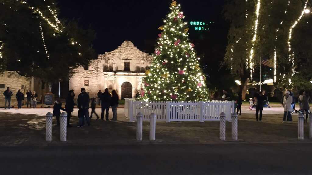
San Antonio with illumination
San Antonio Riverwalk, Illumination late in the evening during Christmas.
Photo: Mobile pic by Ravindra Joisa

San Antonio Riverwalk Boat Tour

The SanAntonio riverwalk boat tour is one of the must-visit tourist attractions. The Riverwalk, which stretches for kilometers and is dotted with cafés and stores, is a popular tourist attraction. If you are wondering how much does it cost to ride the River Walk in San Antonio? The fourteen-dollar boat ride is the finest money you'll ever spend. The Riverwalk is over 15 miles long in total, but the tour focuses on just the downtown loop which is about 2.5 miles. The narrated river cruises are about 35 minutes long. Your guide will share historical and cultural tidbits with your group while keeping things light and humorous.

Also check: Canyon Trail – River Place Nature Trail, Austin, Texas, US

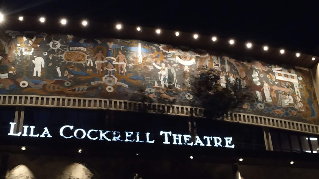
San Antonio Riverwalk
Historic Theatres, seen from San Antonio Riverwalk.
Photo: Mobile pic by Ravindra Joisa

San Antonio Riverwalk Christmas Lights

If you go around the holidays, the trip is very beautiful, with excellent illumination all along the river. November through April is the ideal season to visit San Antonio, with December being the finest. So, you can enjoy the Christmas lights late at night. Moreover, the miniature lighting all along the river at the time of Christmas attracts a lot of crowds. If you're lucky, you could come upon the Lollypop Carriage. A 12-minute city excursion that will set you back at approximately $50.

Tower of Life Building

Is San Antonio Texas worth visiting?

San Antonio is an excellent city for touring, as it is home to some of Texas' most famous historic monuments. Spend some time seeing the Alamo and the city's ancient missions after taking a stroll or a boat along the River Walk.

Are dogs allowed in the river walk?

Dogs are permitted on the River Walk but must be kept on a leash. Many of the outdoor restaurants and stores allow dogs to dine with their owners on their patios. Some restaurants, such as Rita's on the River, even feature pet menus.

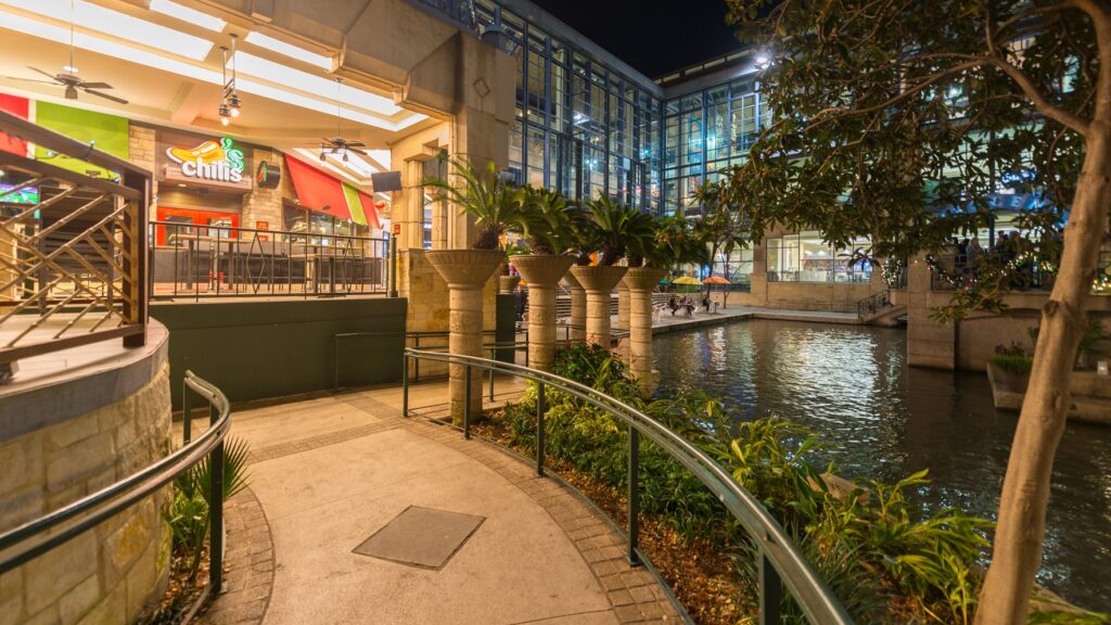
Restaurants and the pedestrian. Photo: by Ravindra Joisa

Where is the best part of San Antonio Riverwalk?

Along the Riverwalk, see a performance at one of the historic theatres, go shopping, witness a parade, or enjoy excellent cuisine. Also, grab a cool drink at the area's oldest pub, to name a few activities. The fluttering flag on top of the tall standing 'Tower of Life Building' and also the 'Tower of the Americas' look prominent. Watch the video till the end. In addition, consider SUBSCRIBING to my YouTube channel to support my work.

https://youtu.be/CEAezPlyzK0

Dochula Pass, Bhutan - Beautiful Panoramic Himalayan View

The National Memorial, Dochu La, or Dochu Pass with 108 stupas or Dochula Chortens is erected in the pass's central hilltop. It's located halfway between Thimphu and Punakha in Bhutan and provides amazing panoramic views of the Himalayan mountain range.

How high is Dochula pass? - Dochula Pass' height is about 3100 meters and the place remains foggy. Around December, the weather in Dochula Pass is perfect and clear, allowing you to observe the Himalayan mountain range. You may expect snowfall early in the year.

Why was the Dochula Pass built?

Dochula Pass history - It was constructed in memory of King Jigme Singye Wangchuck, the fourth 'Druk Gyalpo' (head of state). It was created to accompany the chortens, with a view of the snow forest and the Himalayas. This is a significant center of devotion for the villagers, who visit the monastery practically every day to pray.

 108 Chortens at DochuLa © Ravindra Joisa
108 Chortens at DochuLa © Ravindra Joisa

How do you get to Dochula Pass?

Check the World’s largest mountaintop statue of Buddha Dordenma, which is located in Thimphu. Thimphu to Dochula pass distance - Firstly, the 108 chortens on Dochula Pass, is around 23 kilometers from Thimphu, take 40 minutes to reach. Secondly, to reach Dochula Pass hire a taxi from Thimpu or go for a solo bike ride. With its hairpin twists, dense jungle, up and down mountain passes, the route is reminiscent of traveling through the Western Ghats in southwest India. On reaching Dochula Pass, park your vehicle near the cafe.

Dochula Pass Cafe
Dochula Cafe. © Ravindra Joisa

A visit to the Dochula Cafe

The cafe might be overcrowded with a lot of tourists. You may want to quickly grab a cup of hot coffee and explore the place under cold weather. Moreover, the place is unique and an amazing place to capture photos. You can have the Himalayan mountain range in the background and stupas in the foreground. However, do not make an attempt to climb up the stupas. It is strictly not allowed and is a punishable offense. Basically, in simple words just explore the place and be respectful to Bhutanese culture and tradition.

By the way check out: My Interview with Smart Photography Magazine

 108 Chortens at DochuLa, central tower and flag in Bhutan © Ravindra Joisa
108 Chortens at DochuLa, central tower, and flag. © Ravindra Joisa

A visit to the Druk Wangyel monastery

To the opposite of the 108 chortens is the Druk Wangyel monastery. Firstly, this monastery has a huge statue of Buddha and other deities inside. Secondly, it has paintings depicting the life of Buddha and other stories. The view from the outside is breathtaking. Also, you get to see the 108 chortens from a different angle.

Druk Wangyel monnastery.  © Ravindra Joisa
Druk Wangyel monastery © Ravindra Joisa

Where to go next after Dochula Pass

From here Punakha is another 3 hours drive. By the way, do not forget to visit the mad man's Fertility Temple - Chimi Lhakhang on the way. You'll need to pass the rice fields and view traditional cottages with paintings on the walls. Also, the beautiful view of the Pochu Mochu river. The colorful prayer flags on the way just make the journey even more memorable.

Dochula Pass, 108 Chortens and Cafe.  © Ravindra Joisa
Dochula Pass, 108 Chortens and Cafe. © Ravindra Joisa

Note: Be respectful when you visit some of the places. Outsiders might visit without knowing. For example - The dress code when you enter the monastery, usage of the camera, the staircase entrance at Punakha Dzong - the middle row is for the king, no entry zones for outsiders at the third courtyard of Punakha Dzong, do not make any attempt to climb up the chortens for a photoshoot. The best is to check with your local guide.

To conclude, Dochula Pass is a renowned tourist destination because it provides a breathtaking 360-degree panoramic view of the Himalayan range. The vista is particularly breathtaking on clear winter days. Snowcapped mountains give a stunning backdrop to the tranquility of the 108 chortens that dot the mountain pass. Watch my YouTube video below and consider subscribing to my YouTube channel.

https://youtu.be/5_l3ecLzsII

Vellagavi Village - An incredibly magnificent community

Kodaikanal is a destination I'd want to visit. Every time I visited this location, it was different, and I had a one-of-a-kind experience. So this time, I'll be hiking upward from Kumbakarai to Kodaikanal through Vellagavi village, a path that was formerly used to transport goods under British control, going through lush forests, by a waterfall, and through a quiet settlement. Furthermore, no one wears shoes in this hillside settlement. Vellagavi, close to Kodaika, is well-known for this.

Temples at Vallagavi Village
Temples at Vellagavi Village, Photo Copyright: Ravindra Joisa

Reaching Vallagavi village

The route follows the Kumali-Dindigul highway, with a turnoff to Kumbakkara at Periyakulam. The hike begins in Kumbakkara. The entire hike is in the rain forest and takes about 6 hours to reach the Vellagavi village. Firstly, a temple will greet you as you enter Vellagavi village. Secondly, Vellagavi village is in the heart of the jungle, a settlement of barefoot inhabitants. The locals here consider this place to be holy and the village is super clean.

Vellagavi Government primary school

A place full of temples

A primary school and a playground are located in front of this little isolated community situated in the Kodaikanal mountains. Residents rely on centuries-old paths to travel about because there is no road linking the village to the outside world. There are more temples than dwellings, the hamlet is considered sacred, and no footwear is worn within the community. In addition, folks here go to bed at 7 p.m., soon after sunset.

Vellagavi village Stay

You may stay in motels near the Vellagavi forest reserve before or after the trip. If you are traveling on your own then you might stay at hotels in Kodaikanal. Because this is a perfect two-day weekend trip, you may camp at Vallagavi's "Old Kodai Camping Tents," which is located at the village's entrance and has ready-made erected tents waiting for you to come.

You continue 'barefoot' through the village, through the lone bank/post office and a primary school, to the site where you may spend the evening and camp. It's on the other side of town, away from the people, so you may enjoy the campfire without disturbing the local people at night. There is a location for visitors and hikers to stay near the entrance, as well as a shop. We erected our tent here and spent the evening around the campfire. It was good to sit in front of a campfire and enjoy the peaceful cold night. This is something that I love and usually miss when I go on Himalayan treks where a campfire is not allowed.

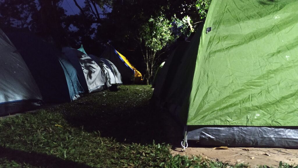
Overnight tent stay at Vallagavi Village
Overnight tent-stay at Vellagavi Village. Photo Copyright: Ravindra Joisa

The uphill hike after Vellagavi village

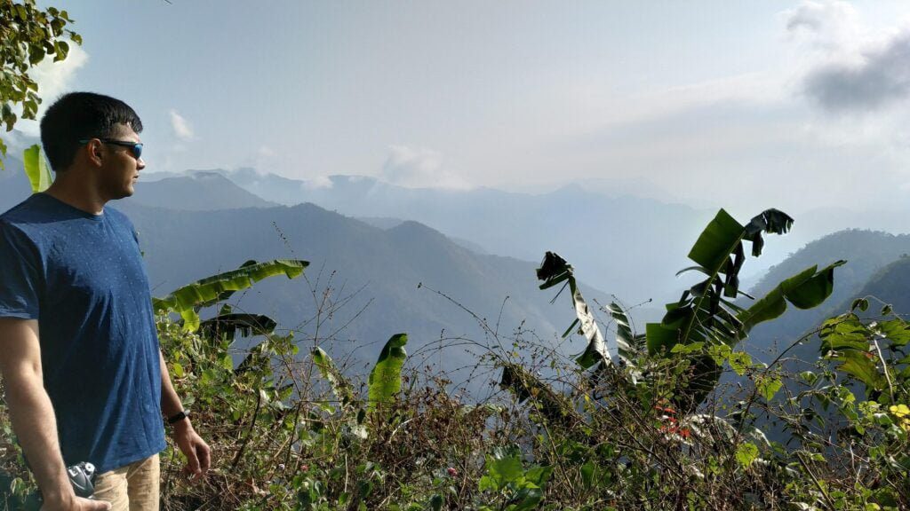
The majority of the hiking track is in the woods. The Western Ghats' jungles are incredibly magnificent. Unfortunately, at the time of my visit, the region right before the dolphin nose area was engulfed in flames, and the hiking route was completely engulfed in ash. We eventually made up to the all-uphill walk to Dolphine nose. Dolphine Nose is a renowned tourist site that is frequently crowded.

Enjoying the Vellagavi Forest view
Enjoying the Vellagavi Forest view. Photo Copyright: Ravindra Joisa

The tragic forest fire above Vellagavi Village

It's worth noting that there was a large forest fire in this section of the climb, right below the Dolphin nose area, not long ago. We were told that a party of all-female hikers became stuck in the middle of the forest and perished in the forest fire. Many people had died. You can see in the video below where the ruins can still be found, and even throughout my trip, the last kilometer was under forest fire but was not intense.

Ravindra Joisa at Vellagavi village

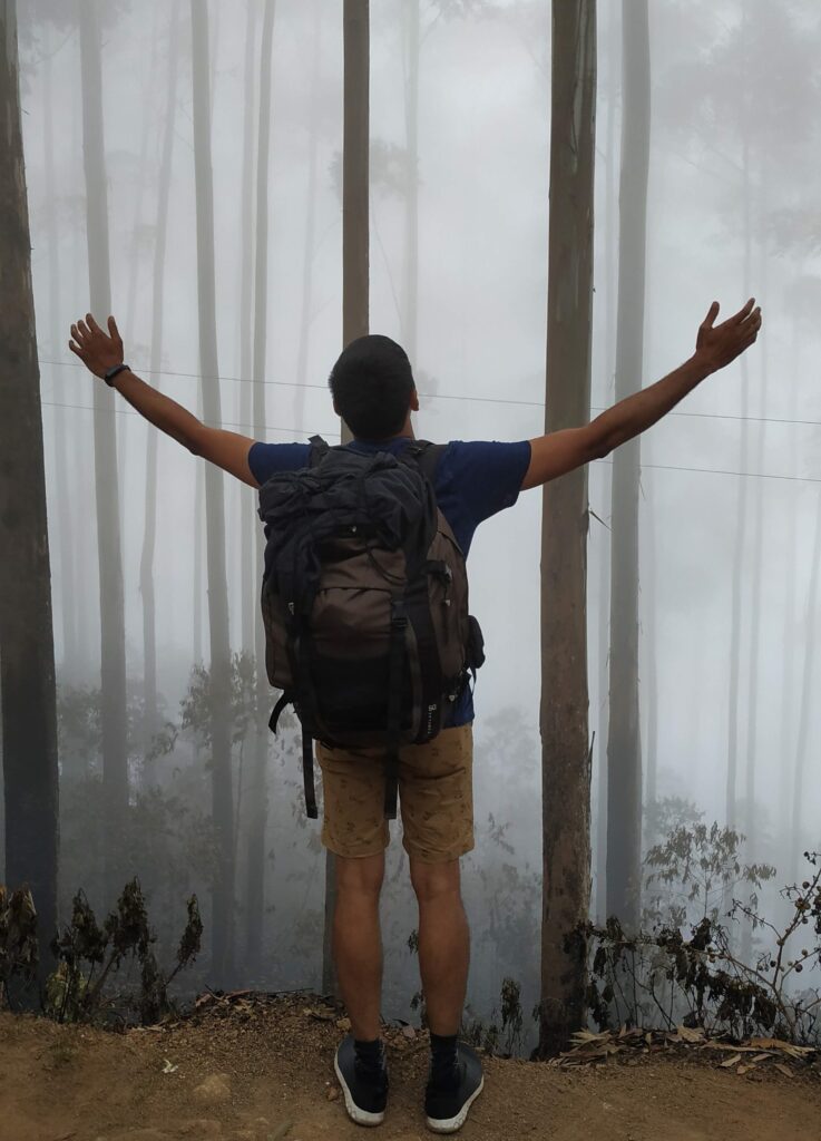
A foggy day, near Dolphin Nose, where there was once a forest fire.

To summarise, this is an ideal weekend trek that includes a stay in a lovely community in the heart of the forest. Watch the movie below, and I hope it is entertaining and even motivates you to arrange a hike to ancient Kodai.

Vallagavi Village to Dolphin Nose, Kodai
Vellagavi Village to Dolphin Nose, Kodai. Photo Copyright: Ravindra Joisa

By the way, the best time to visit this location is during the post-monsoon season, which runs from October to February. Hiking during the monsoon season is not recommended since you will be in the center of a rain forest with lots of rain.

https://youtu.be/apim07rm8PI

By the way, you may want to check my other trekking stories. Hope you enjoyed reading the blog post. You may buy me a coffee to support my work and the effort taken to write this post and make this video. Or the least that you can do is to subscribe to my YouTube channel for more videos and join my FriendZone for more stories.

Chandratal Lake | Nature's beauty at its best

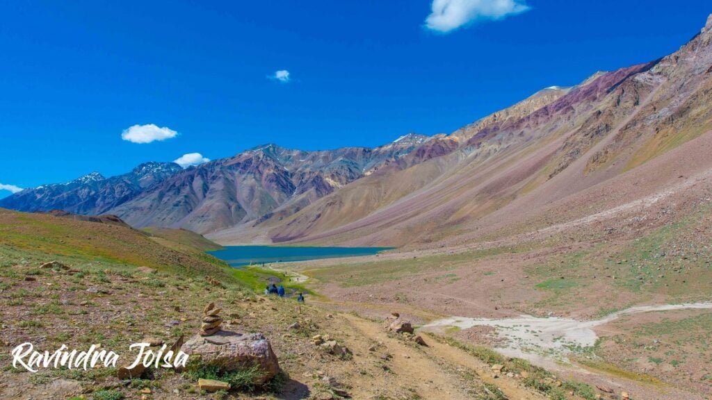
Chandratal is one of the most beautiful lakes located at an altitude of about 14,000 feet. Tso Chikgma or Lake of the Moon or Chandra Taal, or Chandratal is a lake in the Spiti part of the Lahul and Spiti district of Himachal Pradesh, India. The lake is near the source of the Chandra River. Moreover, it was designated as a world heritage site back in 2005. Despite the rugged and inhospitable surroundings at 4300 meters, it is in a protected niche with some flowers and wildlife in summer.

Why is Chandratal famous?

It was also a famous trading location for Tibetan and Ladakhi traders. The lake, with its wandering terrain typical of the secluded Spiti Valley, is a popular walking spot due to its mild climbing grade.

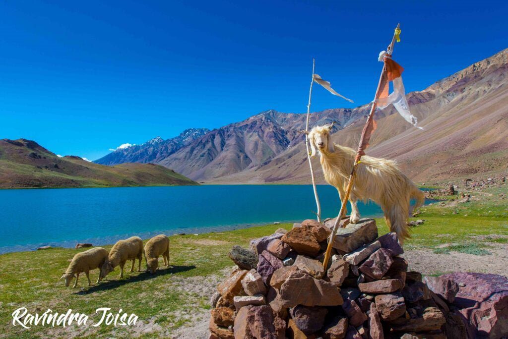
Himalayan Mountain Goat and sheep in front of Chandra Taal

How can I go to Chandratal lake?

Batal is midway between Manali and Kaza. And a diversion from Batal will take you to the lake. Firstly, you can reach Chandratal from Manali which is about 110 kilometers drive. It takes about 2.5 hours non-stop via the new Atal Tunnel. Here the route is right next to the Chenab river. You can go via the famous Rothang Pass to make the drive more adventurous. Secondly, you can reach Chandra Taal from Kaza which is about the same distance and time. Here the route is right next to the Spiti river. On the way, you will be crossing the Kunzum La / Pass [video link].

What is the best time to visit Chandratal lake?

The paths to Chandratal Lake are available for a little more than 4 months, from the third week of June to the first week of November. However, the greatest time to visit Chandratal Lake is in September, when there is a good possibility of seeing flowering flora and wildlife, breathtaking terrain, and brilliant blue sky. During the following months, it will be blanketed in snow.

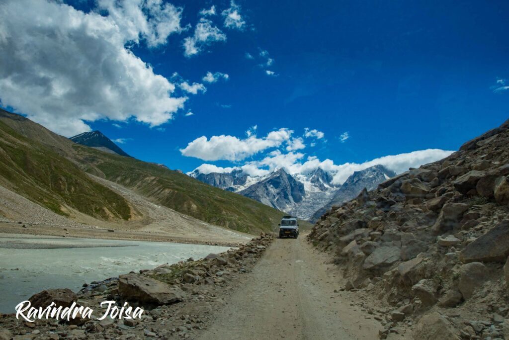
Dirt road drive from Manali to Chandra Taal next to river Chenab

Is camping allowed near Chandratal lake?

Can we stay at Chandratal lake? - Chandra Taal is a tourist destination for trekkers and campers. The lake is accessible on foot from Batal as well as from Kunzum Pass from late May to early October. There is also a motor road accessible as far as the parking lot, 1 kilometer from the lake. The lake is also accessible from Suraj Tal, 30 kilometers away. There are vast meadows on the banks of the lake. Expect these meadows to be full of wildflowers, during springtime.

We couldn't spend much time exploring the beautiful landscape as the only mode of transport did not want to drive back once it is dark. The place and surroundings have almost zero human habitation, with just a few campsites. The nearest fuel station or repair shops are a few hours of drive away and no one wants to take the risk of driving after dark on this dirt road. You may stay overnight at ChaCha - ChaChi Dabha or near Batal.

Final hike from the parking area to the Chandra Taal Lake, the first glimpse

Short hike just before the lake

You will not be able to drive all the way to the Chandratal. From the parking area, be ready for a short mile-long hike. I have been to this place twice. Firstly, after completing the last day of the Hampta Pass, on a clear day from the Chhatru campsite. Secondly, on the way to Kaza during the Kanomo Peak trek. Even though this mile-long hike is more of a flat walk, you can feel short of breath and is still in the high altitude danger zone. There are chances of getting altitude sickness as Chandratal is at 14,000 feet.

Ravindra Joisa at Chandra Taal

Why is Chandratal lake famous?

According to Hindu mythology, Chandratal is the location where Indra, the King of Gods, arrived in his chariot to carry Yudhishthira, the eldest of the five Pandavas, to Swarga in his mortal form (heaven). Fairies, according to locals, visit the lake at night.

Chandratal lake mystery

The glacier at Baralacha Pass is its source, but how the water gets from the glacier to the lake is a mystery in and of itself. Suraj Taal is said to be called after Bhaga, the son of the sun deity, and Chandratal after Chandra.

To conclude, even though the journey to this place is a bumpy drive on a dangerous mud road next to the Chenab river. The picturesque lake is worth the effort to reach this remote place. The landscape on the way is breathtaking. There are no stops to fuel your vehicle and just a few Dabhas to keep the hunger away. As of this writing, camping next to the lake is not allowed as per the new rules made by the government. This is to save the beautiful place from irresponsible tourists. The next place to visit around is the Kunzum pass.

Read Next: Mount Kanamo Basecamp High altitude Himalayan Trek

Also, check out my YouTube video of my visit to Chandra Taal lake and consider SUBSCRIBING to my channel to support my work.

https://youtu.be/h1rUVWy_JKc

Hampta Pass Trek | Scenic awesome campsites to relish

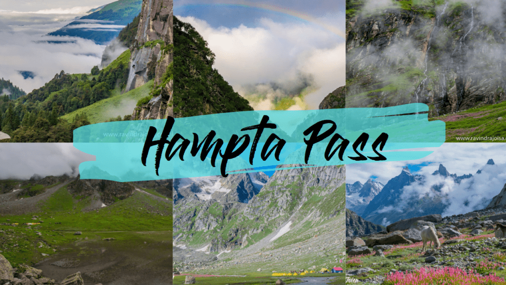
When it comes to Himachal treks, the Hampta Pass trip is one that no one forgets. At 14,000 feet, Himachal Pradesh's Hampta Pass is one of the Himalayas' uncommon and stunning pass crossings. To begin, the lush green valley of Kullu, with woods, grasslands, and flowers in bloom, is on one side of the route. Second, the scenery of Lahaul is virtually desert, with barren mountains on one side and scant vegetation on the other. In summary, the scenery on each side of the pass, as seen from the pass's summit, is a world apart.

Hampta Pass trek
Hampta Pass trek. Photos by Ravindra Joisa

Who can complete Hampta Pass trek

The hike may be accomplished in five days by an ordinary individual or a first-time hiker in the Himalayas. It's a medium-difficulty slope. In Hampta Pass, the weather is chilly yet manageable. Summer or monsoon season, which spans from June to September, is also the greatest time to go on a trek to observe the brilliant meadows. You can follow this day-by-day plan to get a feel of how the hike will progress.

Hampta Pass trek Itinerary

Day 1 – Start from Manali bus stand, drive uphill, and trek to Jobra
Day 2 – Cross the stream and hike to Jwara, pick wild strawberries
Day 3 – Hike to Balu Ka Ghera, spot the cave.
Day 4 – Hike to Shea Goru via Hampta Pass, a glimpse of Mt Indrasan
Day 5 – Cross Stream, hike to Chhatru Campsite, end of Hampta Pass trek
Day 6 - Explore Chandratal (lake) and Kunzum pass
Day 7 - Visit Rothang Pass or cross Atal Tunnel.

Ravindra Joisa after Crossing Hampta Pass in Himachal

Trek to Jobra, start of Hampta Pass trek

The journey begins at the Manali bus station and concludes at the hydel plant and reservoir. From here, you'll have to trek for another 45 minutes to get to basecamp. The route leads through pine trees and a few maple trees as you approach the woodland. In addition, the meadows form the final stretch as you exit the forest. For more details on day 1 of the Hampta Pass trek read trek to Jobra Campsite and watch this video. By the way, consider subscribing to my YouTube channel to support my work.

https://www.youtube.com/watch?v=PdCWUqVIkm0

Trek to Jwara

The second day of the Hampta Pass route from Jobra to Jwara is empyrean. There's also the best landscape, a waterfall, a flower bed, a hiking trail right next to the stream, between the stones, and an ice-cold stream crossing. There's also a magnificent campsite where ice-capped mountains play hide-and-seek with clouds and fog. This is the best place for nature enthusiasts. For more details on day 2 of the Hampta Pass trek, read trek to Jwara Campsite and watch this video.

https://www.youtube.com/watch?v=UII6FbTNqi8

Trek to Balu Ka Ghera

Balu ka Ghera campground is a somewhat difficult trek that leads to another wonderful camping. It begins with a brief meadow walk, followed by a two-hour boulder section, and then a route on loose rocks all the way to the campground. Jwara, by the way, is one of the most gorgeous Himalayan campsites. For more details on day 3 of the Hampta Pass trek, read trek to Balu Ka Ghera and watch this video.

https://www.youtube.com/watch?v=NYLOC_p3Ea8

Trek to Shea Goru via Hampta Pass

It takes a couple of hours to climb to Shea Goru through Hampta Pass. After passing across the pass, the route descends steeply. When you're at the pass, you may view some incredible scenery, from the most gorgeous valleys to mountain peaks and glaciers. This is the most difficult day of the journey. It might be difficult and unsafe in certain situations. For more details on day 4 of the Hampta Pass trek read trek to Shea Goru via Hampta Pass and watch this video.

https://www.youtube.com/watch?v=P-HfEx4rZEU

Trek to Chhatru Campsite, end of Hampta Pass trek

The Chenab river is crossed on Day 5 of the Hampta Pass trek from Shea Goru to Chhatru camping. To begin, the hike from SheaGoru to Chhatru in Himachal Pradesh is a pleasant 2-2.5 hour walk over moraine and lost rocks on gradual inclines. Then, after crossing a few glacier flows, you'll descend to Chhatru. Furthermore, as you approach closer to the road, the drop becomes steeper and more difficult. Finally, the walk comes to a close adjacent to the Chenab river and concludes at the bridge. For more details on day 5 of the Hampta Pass trek read trek to Chhatru Campsite and watch this video.

https://www.youtube.com/watch?v=o3nNAmVfWZ4

Before you go on a hike make sure to check this out - some of the Absolute mandatory Hiking Accessories to carry.

A visit to the most picturesque lake - Chandratal

Chandra Taal is one of the most beautiful lakes located at an altitude of about 14,000 feet. Tso Chikgma or Lake of the Moon or Chandra Taal, or Chandratal is a lake in the Spiti part of the Lahul and Spiti district of Himachal Pradesh, India. The lake is near the source of the Chandra River.

Moreover, it was designated as a world heritage site back in 2005. Despite the rugged and inhospitable surroundings at 4300 meters, it is in a protected niche with some flowers and wildlife in summer. Moreover, the lake is not too far from the Chhatru campsite. For more details on Chandra Taal (lake) read Chandra Taal, the most picturesque lake in Spiti valley, and in addition, watch this video. From Chandratal you can go back to Manali via Rothang Pass or the new Atul tunnel or go further to Leh which is another day of a journey by bus.

https://www.youtube.com/watch?v=h1rUVWy_JKc

To conclude, this is one of the best Himalayan treks to start with. The trek is not too easy but at the same time not too challenging. Firstly, this is a no ordinary hike, and the experience you gain is worth the time and money you spend here. Secondly, if you are a landscape photographer then this is a must-visit place. Moreover, the trek isn't too expensive and the Hampta pass trek package will cost under ₹ 10,000 and totally worth it.